You are here: Home > Network List > TA - USArray Transportable Network (new EarthScope stations) Stations List
> Station R54A Victor, WV, USA > Earthquake Result Viewer
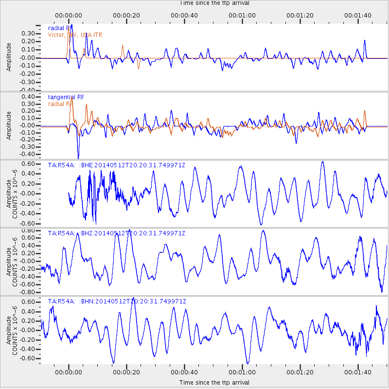
R54A Victor, WV, USA - Earthquake Result Viewer
*The percent match for this event was below the threshold and hence no stack was calculated.
| Earthquake location: |
Southern East Pacific Rise |
| Earthquake latitude/longitude: |
-49.7/-115.3 |
| Earthquake time(UTC): |
2014/05/12 (132) 20:07:51 GMT |
| Earthquake Depth: |
10 km |
| Earthquake Magnitude: |
5.4 MW |
| Earthquake Catalog/Contributor: |
ISC/ISC |
|
| Network: |
TA USArray Transportable Network (new EarthScope stations) |
| Station: |
R54A Victor, WV, USA |
| Lat/Lon: |
38.18 N/80.99 W |
| Elevation: |
512 m |
|
| Distance: |
92.6 deg |
| Az: |
26.433 deg |
| Baz: |
201.539 deg |
| Ray Param: |
$rayparam |
*The percent match for this event was below the threshold and hence was not used in the summary stack. |
|
| Radial Match: |
65.32045 % |
| Radial Bump: |
400 |
| Transverse Match: |
61.823196 % |
| Transverse Bump: |
400 |
| SOD ConfigId: |
3390531 |
| Insert Time: |
2019-04-11 20:24:59.031 +0000 |
| GWidth: |
2.5 |
| Max Bumps: |
400 |
| Tol: |
0.001 |
|
Signal To Noise
| Channel | StoN | STA | LTA |
| TA:R54A: :BHZ:20140512T20:20:31.749971Z | 1.5369989 | 4.150465E-7 | 2.7003696E-7 |
| TA:R54A: :BHN:20140512T20:20:31.749971Z | 0.4673277 | 1.3294472E-7 | 2.8447857E-7 |
| TA:R54A: :BHE:20140512T20:20:31.749971Z | 1.0245782 | 2.3553787E-7 | 2.2988765E-7 |
| Arrivals |
| Ps | |
| PpPs | |
| PsPs/PpSs | |


