You are here: Home > Network List > TA - USArray Transportable Network (new EarthScope stations) Stations List
> Station W57A Gilead, NC, USA > Earthquake Result Viewer
W57A Gilead, NC, USA - Earthquake Result Viewer

| Earthquake location: |
Southern East Pacific Rise |
| Earthquake latitude/longitude: |
-49.7/-115.3 |
| Earthquake time(UTC): |
2014/05/12 (132) 20:07:51 GMT |
| Earthquake Depth: |
10 km |
| Earthquake Magnitude: |
5.4 MW |
| Earthquake Catalog/Contributor: |
ISC/ISC |
|
| Network: |
TA USArray Transportable Network (new EarthScope stations) |
| Station: |
W57A Gilead, NC, USA |
| Lat/Lon: |
35.15 N/79.99 W |
| Elevation: |
85 m |
|
| Distance: |
90.1 deg |
| Az: |
28.301 deg |
| Baz: |
202.089 deg |
| Ray Param: |
0.041699726 |
| Estimated Moho Depth: |
57.5 km |
| Estimated Crust Vp/Vs: |
1.72 |
| Assumed Crust Vp: |
6.565 km/s |
| Estimated Crust Vs: |
3.811 km/s |
| Estimated Crust Poisson's Ratio: |
0.25 |
|
| Radial Match: |
84.06138 % |
| Radial Bump: |
400 |
| Transverse Match: |
76.944534 % |
| Transverse Bump: |
400 |
| SOD ConfigId: |
3390531 |
| Insert Time: |
2019-04-11 20:25:08.739 +0000 |
| GWidth: |
2.5 |
| Max Bumps: |
400 |
| Tol: |
0.001 |
|
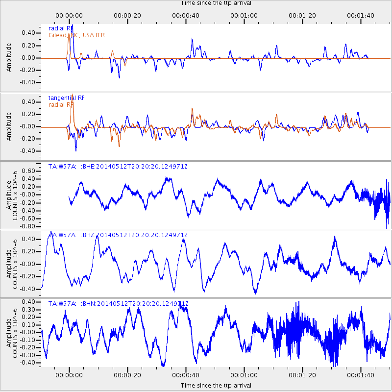
Signal To Noise
| Channel | StoN | STA | LTA |
| TA:W57A: :BHZ:20140512T20:20:20.124971Z | 0.9344833 | 2.5408846E-7 | 2.7190262E-7 |
| TA:W57A: :BHN:20140512T20:20:20.124971Z | 0.7729799 | 1.0299559E-7 | 1.3324485E-7 |
| TA:W57A: :BHE:20140512T20:20:20.124971Z | 1.6283561 | 2.6320978E-7 | 1.6164141E-7 |
| Arrivals |
| Ps | 6.5 SECOND |
| PpPs | 23 SECOND |
| PsPs/PpSs | 30 SECOND |


