You are here: Home > Network List > G - GEOSCOPE Stations List
> Station NOUC Port Laguerre, New Caledonia > Earthquake Result Viewer
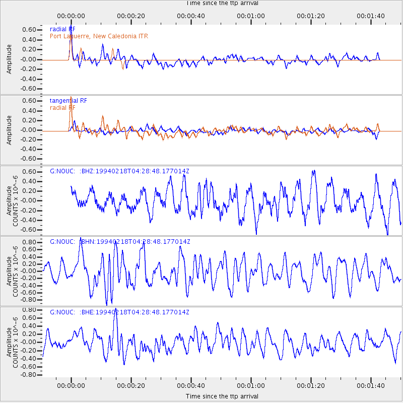
NOUC Port Laguerre, New Caledonia - Earthquake Result Viewer
*The percent match for this event was below the threshold and hence no stack was calculated.
| Earthquake location: |
Southeast Indian Ridge |
| Earthquake latitude/longitude: |
-45.3/96.2 |
| Earthquake time(UTC): |
1994/02/18 (049) 04:19:07 GMT |
| Earthquake Depth: |
10 km |
| Earthquake Magnitude: |
5.5 MB, 6.2 MS, 6.3 UNKNOWN |
| Earthquake Catalog/Contributor: |
WHDF/NEIC |
|
| Network: |
G GEOSCOPE |
| Station: |
NOUC Port Laguerre, New Caledonia |
| Lat/Lon: |
22.10 S/166.30 E |
| Elevation: |
112 m |
|
| Distance: |
60.8 deg |
| Az: |
92.644 deg |
| Baz: |
229.52 deg |
| Ray Param: |
$rayparam |
*The percent match for this event was below the threshold and hence was not used in the summary stack. |
|
| Radial Match: |
64.5101 % |
| Radial Bump: |
400 |
| Transverse Match: |
46.66318 % |
| Transverse Bump: |
400 |
| SOD ConfigId: |
4480 |
| Insert Time: |
2010-02-26 23:39:02.793 +0000 |
| GWidth: |
2.5 |
| Max Bumps: |
400 |
| Tol: |
0.001 |
|
Signal To Noise
| Channel | StoN | STA | LTA |
| G:NOUC: :BHN:19940218T04:28:48.177014Z | 2.6220233 | 4.0652745E-7 | 1.5504341E-7 |
| G:NOUC: :BHE:19940218T04:28:48.177014Z | 1.403827 | 2.2734777E-7 | 1.6194858E-7 |
| G:NOUC: :BHZ:19940218T04:28:48.177014Z | 1.6557394 | 2.3689405E-7 | 1.4307447E-7 |
| Arrivals |
| Ps | |
| PpPs | |
| PsPs/PpSs | |


