You are here: Home > Network List > GS - US Geological Survey Networks Stations List
> Station KAN10 Keim Farm > Earthquake Result Viewer
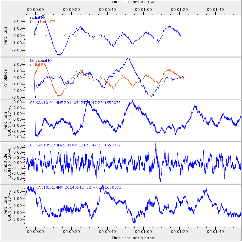
KAN10 Keim Farm - Earthquake Result Viewer
*The percent match for this event was below the threshold and hence no stack was calculated.
| Earthquake location: |
Near East Coast Of Honshu, Japan |
| Earthquake latitude/longitude: |
35.6/140.1 |
| Earthquake time(UTC): |
2014/05/12 (132) 23:35:02 GMT |
| Earthquake Depth: |
58 km |
| Earthquake Magnitude: |
5.0 MW |
| Earthquake Catalog/Contributor: |
ISC/ISC |
|
| Network: |
GS US Geological Survey Networks |
| Station: |
KAN10 Keim Farm |
| Lat/Lon: |
37.12 N/98.10 W |
| Elevation: |
417 m |
|
| Distance: |
89.7 deg |
| Az: |
42.799 deg |
| Baz: |
316.118 deg |
| Ray Param: |
$rayparam |
*The percent match for this event was below the threshold and hence was not used in the summary stack. |
|
| Radial Match: |
45.89593 % |
| Radial Bump: |
400 |
| Transverse Match: |
50.402454 % |
| Transverse Bump: |
400 |
| SOD ConfigId: |
3390531 |
| Insert Time: |
2019-04-11 20:30:20.167 +0000 |
| GWidth: |
2.5 |
| Max Bumps: |
400 |
| Tol: |
0.001 |
|
Signal To Noise
| Channel | StoN | STA | LTA |
| GS:KAN10:01:HHZ:20140512T23:47:23.165007Z | 1.1062272 | 3.1848325E-7 | 2.879004E-7 |
| GS:KAN10:01:HHN:20140512T23:47:23.165007Z | 1.4547487 | 1.3935922E-6 | 9.579609E-7 |
| GS:KAN10:01:HHE:20140512T23:47:23.165007Z | 3.6723475 | 3.2058401E-6 | 8.729675E-7 |
| Arrivals |
| Ps | |
| PpPs | |
| PsPs/PpSs | |


