You are here: Home > Network List > G - GEOSCOPE Stations List
> Station NOUC Port Laguerre, New Caledonia > Earthquake Result Viewer
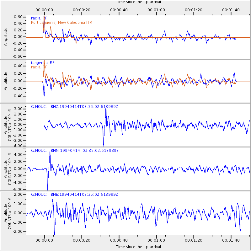
NOUC Port Laguerre, New Caledonia - Earthquake Result Viewer
*The percent match for this event was below the threshold and hence no stack was calculated.
| Earthquake location: |
Banda Sea |
| Earthquake latitude/longitude: |
-6.6/129.7 |
| Earthquake time(UTC): |
1994/04/14 (104) 03:28:26 GMT |
| Earthquake Depth: |
170 km |
| Earthquake Magnitude: |
5.8 MB |
| Earthquake Catalog/Contributor: |
WHDF/NEIC |
|
| Network: |
G GEOSCOPE |
| Station: |
NOUC Port Laguerre, New Caledonia |
| Lat/Lon: |
22.10 S/166.30 E |
| Elevation: |
112 m |
|
| Distance: |
38.6 deg |
| Az: |
117.43 deg |
| Baz: |
288.036 deg |
| Ray Param: |
$rayparam |
*The percent match for this event was below the threshold and hence was not used in the summary stack. |
|
| Radial Match: |
66.36886 % |
| Radial Bump: |
400 |
| Transverse Match: |
72.487175 % |
| Transverse Bump: |
400 |
| SOD ConfigId: |
4480 |
| Insert Time: |
2010-02-26 23:39:10.869 +0000 |
| GWidth: |
2.5 |
| Max Bumps: |
400 |
| Tol: |
0.001 |
|
Signal To Noise
| Channel | StoN | STA | LTA |
| G:NOUC: :BHN:19940414T03:35:02.613989Z | 5.311832 | 2.124359E-6 | 3.9992963E-7 |
| G:NOUC: :BHE:19940414T03:35:02.613989Z | 1.6622758 | 5.2296105E-7 | 3.1460547E-7 |
| G:NOUC: :BHZ:19940414T03:35:02.613989Z | 4.198272 | 1.4657963E-6 | 3.4914274E-7 |
| Arrivals |
| Ps | |
| PpPs | |
| PsPs/PpSs | |


