You are here: Home > Network List > TA - USArray Transportable Network (new EarthScope stations) Stations List
> Station M36A Felix, Anita, IA, USA > Earthquake Result Viewer
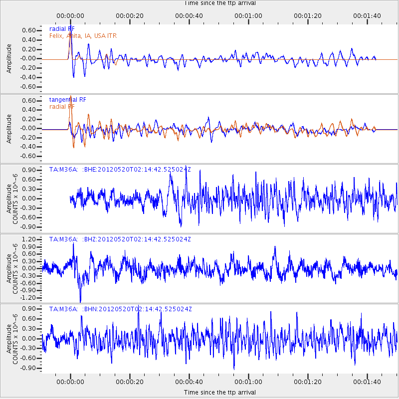
M36A Felix, Anita, IA, USA - Earthquake Result Viewer
*The percent match for this event was below the threshold and hence no stack was calculated.
| Earthquake location: |
Northern Italy |
| Earthquake latitude/longitude: |
44.9/11.2 |
| Earthquake time(UTC): |
2012/05/20 (141) 02:03:52 GMT |
| Earthquake Depth: |
6.3 km |
| Earthquake Magnitude: |
5.8 MB, 6.0 MS, 6.0 MW, 6.1 MW |
| Earthquake Catalog/Contributor: |
WHDF/NEIC |
|
| Network: |
TA USArray Transportable Network (new EarthScope stations) |
| Station: |
M36A Felix, Anita, IA, USA |
| Lat/Lon: |
41.45 N/94.80 W |
| Elevation: |
430 m |
|
| Distance: |
71.6 deg |
| Az: |
310.398 deg |
| Baz: |
46.068 deg |
| Ray Param: |
$rayparam |
*The percent match for this event was below the threshold and hence was not used in the summary stack. |
|
| Radial Match: |
62.005524 % |
| Radial Bump: |
400 |
| Transverse Match: |
43.70148 % |
| Transverse Bump: |
400 |
| SOD ConfigId: |
446234 |
| Insert Time: |
2012-08-25 17:31:55.807 +0000 |
| GWidth: |
2.5 |
| Max Bumps: |
400 |
| Tol: |
0.001 |
|
Signal To Noise
| Channel | StoN | STA | LTA |
| TA:M36A: :BHZ:20120520T02:14:42.525024Z | 3.8142703 | 5.2303034E-7 | 1.3712462E-7 |
| TA:M36A: :BHN:20120520T02:14:42.525024Z | 1.5956413 | 2.806773E-7 | 1.7590251E-7 |
| TA:M36A: :BHE:20120520T02:14:42.525024Z | 2.3830452 | 3.8598643E-7 | 1.6197193E-7 |
| Arrivals |
| Ps | |
| PpPs | |
| PsPs/PpSs | |


