PAF Port aux Francais, Kerguelen (South Indian Ocean) - Earthquake Result Viewer
Earthquake location: Volcano Islands, Japan Region
Earthquake latitude/longitude: 22.3/143.7
Earthquake time(UTC): 2000/03/28 (088) 11:00:22 GMT
Earthquake Depth: 126 km
Earthquake Magnitude: 6.8 MB, 7.6 MS, 7.6 MW, 7.6 MW
Earthquake Catalog/Contributor: WHDF/NEIC
Network: G GEOSCOPE
Station: PAF Port aux Francais, Kerguelen (South Indian Ocean)
Lat/Lon: 49.35 S/70.21 E
Elevation: 17 m
Distance: 96.6 deg
Az: 219.138 deg
Baz: 63.334 deg
Ray Param: 0.040376112
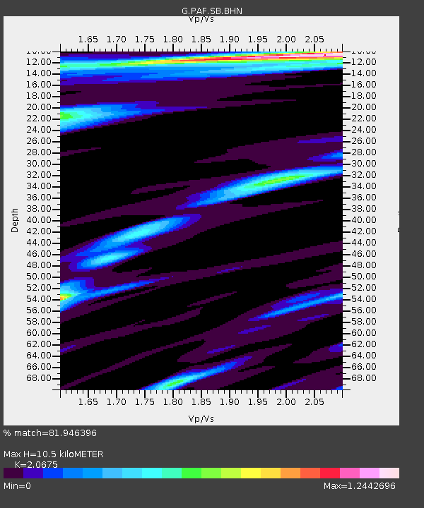
Estimated Moho Depth: 10.5 km
Estimated Crust Vp/Vs: 2.07
Assumed Crust Vp: 4.73 km/s
Estimated Crust Vs: 2.288 km/s
Estimated Crust Poisson's Ratio: 0.35
Radial Match: 81.946396 %
Radial Bump: 400
Transverse Match: 53.803864 %
Transverse Bump: 400
SOD ConfigId: 3744
Insert Time: 2010-02-26 23:39:39.068 +0000
GWidth: 2.5
Max Bumps: 400
Tol: 0.001

Signal To Noise

ChannelStoNSTALTA
G:PAF:SB:BHN:20000328T11:13:06.431997Z1.7031851.9547535E-61.1477048E-6
G:PAF:SB:BHE:20000328T11:13:06.431997Z1.8131582.4446222E-61.3482676E-6
G:PAF:SB:BHZ:20000328T11:13:06.431997Z1.70074743.2060937E-61.8851088E-6
Arrivals
Ps2.4 SECOND
PpPs6.7 SECOND
PsPs/PpSs9.1 SECOND