You are here: Home > Network List > TA - USArray Transportable Network (new EarthScope stations) Stations List
> Station A31A Linda, St. Vincent, MN, USA > Earthquake Result Viewer
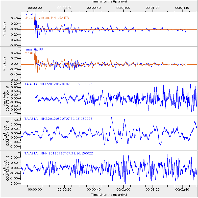
A31A Linda, St. Vincent, MN, USA - Earthquake Result Viewer
*The percent match for this event was below the threshold and hence no stack was calculated.
| Earthquake location: |
Off East Coast Of Honshu, Japan |
| Earthquake latitude/longitude: |
39.5/143.2 |
| Earthquake time(UTC): |
2012/05/20 (141) 07:19:54 GMT |
| Earthquake Depth: |
11 km |
| Earthquake Magnitude: |
5.6 MB |
| Earthquake Catalog/Contributor: |
WHDF/NEIC |
|
| Network: |
TA USArray Transportable Network (new EarthScope stations) |
| Station: |
A31A Linda, St. Vincent, MN, USA |
| Lat/Lon: |
48.93 N/97.19 W |
| Elevation: |
244 m |
|
| Distance: |
77.0 deg |
| Az: |
36.067 deg |
| Baz: |
316.35 deg |
| Ray Param: |
$rayparam |
*The percent match for this event was below the threshold and hence was not used in the summary stack. |
|
| Radial Match: |
74.38907 % |
| Radial Bump: |
400 |
| Transverse Match: |
46.946507 % |
| Transverse Bump: |
400 |
| SOD ConfigId: |
446234 |
| Insert Time: |
2012-08-25 18:27:16.169 +0000 |
| GWidth: |
2.5 |
| Max Bumps: |
400 |
| Tol: |
0.001 |
|
Signal To Noise
| Channel | StoN | STA | LTA |
| TA:A31A: :BHZ:20120520T07:31:16.15002Z | 2.7344868 | 3.0000564E-7 | 1.09711856E-7 |
| TA:A31A: :BHN:20120520T07:31:16.15002Z | 1.6152536 | 2.3462309E-7 | 1.4525465E-7 |
| TA:A31A: :BHE:20120520T07:31:16.15002Z | 1.4136904 | 1.9668195E-7 | 1.3912661E-7 |
| Arrivals |
| Ps | |
| PpPs | |
| PsPs/PpSs | |


