You are here: Home > Network List > TA - USArray Transportable Network (new EarthScope stations) Stations List
> Station L39A Vinton, IA, USA > Earthquake Result Viewer
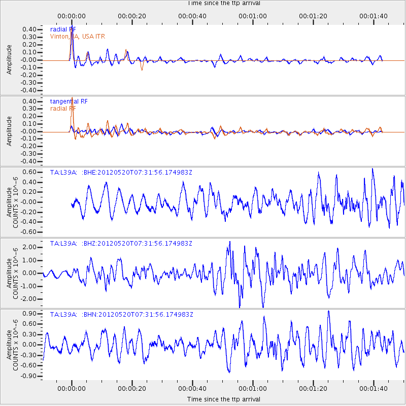
L39A Vinton, IA, USA - Earthquake Result Viewer
*The percent match for this event was below the threshold and hence no stack was calculated.
| Earthquake location: |
Off East Coast Of Honshu, Japan |
| Earthquake latitude/longitude: |
39.5/143.2 |
| Earthquake time(UTC): |
2012/05/20 (141) 07:19:54 GMT |
| Earthquake Depth: |
11 km |
| Earthquake Magnitude: |
5.6 MB |
| Earthquake Catalog/Contributor: |
WHDF/NEIC |
|
| Network: |
TA USArray Transportable Network (new EarthScope stations) |
| Station: |
L39A Vinton, IA, USA |
| Lat/Lon: |
42.12 N/92.00 W |
| Elevation: |
261 m |
|
| Distance: |
84.5 deg |
| Az: |
37.885 deg |
| Baz: |
320.341 deg |
| Ray Param: |
$rayparam |
*The percent match for this event was below the threshold and hence was not used in the summary stack. |
|
| Radial Match: |
78.97317 % |
| Radial Bump: |
302 |
| Transverse Match: |
56.914303 % |
| Transverse Bump: |
400 |
| SOD ConfigId: |
446234 |
| Insert Time: |
2012-08-25 18:34:22.046 +0000 |
| GWidth: |
2.5 |
| Max Bumps: |
400 |
| Tol: |
0.001 |
|
Signal To Noise
| Channel | StoN | STA | LTA |
| TA:L39A: :BHZ:20120520T07:31:56.174983Z | 2.1492805 | 4.2209712E-7 | 1.9638995E-7 |
| TA:L39A: :BHN:20120520T07:31:56.174983Z | 0.6862296 | 1.5423838E-7 | 2.2476206E-7 |
| TA:L39A: :BHE:20120520T07:31:56.174983Z | 0.6256403 | 1.11216856E-7 | 1.7776485E-7 |
| Arrivals |
| Ps | |
| PpPs | |
| PsPs/PpSs | |


