WMQ Urumqi, Xinjiang Province, China - Earthquake Result Viewer
Earthquake location: Off East Coast Of Honshu, Japan
Earthquake latitude/longitude: 39.6/143.2
Earthquake time(UTC): 2012/05/20 (141) 07:20:36 GMT
Earthquake Depth: 11 km
Earthquake Magnitude: 5.9 MB, 6.2 MS, 6.3 MW, 6.3 MW
Earthquake Catalog/Contributor: WHDF/NEIC
Network: IC New China Digital Seismograph Network
Station: WMQ Urumqi, Xinjiang Province, China
Lat/Lon: 43.81 N/87.70 E
Elevation: 850 m
Distance: 40.9 deg
Az: 294.506 deg
Baz: 76.046 deg
Ray Param: 0.07409643
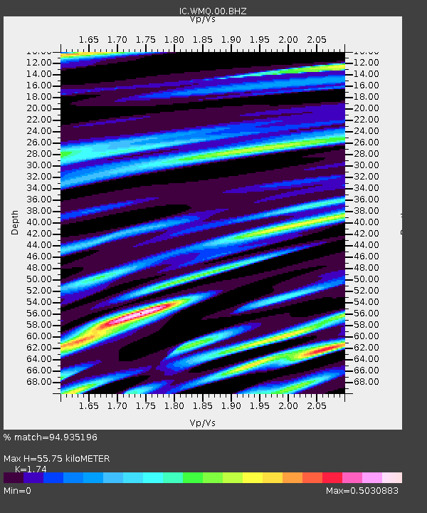
Estimated Moho Depth: 55.75 km
Estimated Crust Vp/Vs: 1.74
Assumed Crust Vp: 6.242 km/s
Estimated Crust Vs: 3.587 km/s
Estimated Crust Poisson's Ratio: 0.25
Radial Match: 94.935196 %
Radial Bump: 400
Transverse Match: 89.41124 %
Transverse Bump: 400
SOD ConfigId: 446234
Insert Time: 2012-08-25 18:50:46.963 +0000
GWidth: 2.5
Max Bumps: 400
Tol: 0.001

Signal To Noise

ChannelStoNSTALTA
IC:WMQ:00:BHZ:20120520T07:27:48.497014Z0.837315441.447107E-61.7282698E-6
IC:WMQ:00:BHN:20120520T07:27:48.497014Z1.29885178.3683034E-76.4428474E-7
IC:WMQ:00:BHE:20120520T07:27:48.497014Z0.721262167.5161523E-71.0420833E-6
Arrivals
Ps7.1 SECOND
PpPs23 SECOND
PsPs/PpSs30 SECOND