K04D Chiloquin, OR, USA - Earthquake Result Viewer
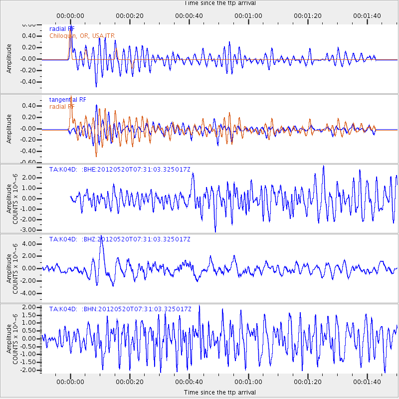
Earthquake location: Off East Coast Of Honshu, Japan
Earthquake latitude/longitude: 39.6/143.2
Earthquake time(UTC): 2012/05/20 (141) 07:20:36 GMT
Earthquake Depth: 11 km
Earthquake Magnitude: 5.9 MB, 6.2 MS, 6.3 MW, 6.3 MW
Earthquake Catalog/Contributor: WHDF/NEIC
Network: TA USArray Transportable Network (new EarthScope stations)
Station: K04D Chiloquin, OR, USA
Lat/Lon: 42.62 N/121.75 W
Elevation: 1315 m
Distance: 67.8 deg
Az: 52.579 deg
Baz: 303.818 deg
Ray Param: 0.056737103
Estimated Moho Depth: 45.5 km
Estimated Crust Vp/Vs: 1.74
Assumed Crust Vp: 6.597 km/s
Estimated Crust Vs: 3.803 km/s
Estimated Crust Poisson's Ratio: 0.25
Radial Match: 83.81012 %
Radial Bump: 400
Transverse Match: 72.500786 %
Transverse Bump: 400
SOD ConfigId: 446234
Insert Time: 2012-08-25 18:53:35.940 +0000
GWidth: 2.5
Max Bumps: 400
Tol: 0.001

Signal To Noise

ChannelStoNSTALTA
TA:K04D: :BHZ:20120520T07:31:03.325017Z0.621281743.0971955E-74.9851707E-7
TA:K04D: :BHN:20120520T07:31:03.325017Z1.22346814.45067E-73.6377492E-7
TA:K04D: :BHE:20120520T07:31:03.325017Z0.860128054.907878E-75.7059856E-7
Arrivals
Ps5.3 SECOND
PpPs18 SECOND
PsPs/PpSs23 SECOND