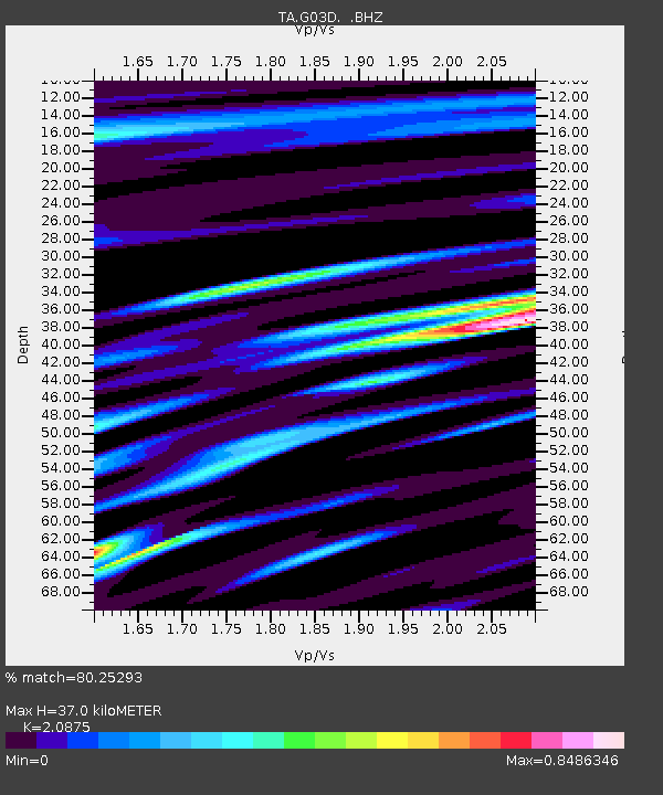
G03D McMinnville, OR, USA - Earthquake Result Viewer
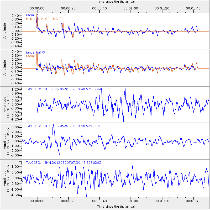
Earthquake location: Off East Coast Of Honshu, Japan
Earthquake latitude/longitude: 39.6/143.2
Earthquake time(UTC): 2012/05/20 (141) 07:20:36 GMT
Earthquake Depth: 11 km
Earthquake Magnitude: 5.9 MB, 6.2 MS, 6.3 MW, 6.3 MW
Earthquake Catalog/Contributor: WHDF/NEIC
Network: TA USArray Transportable Network (new EarthScope stations)
Station: G03D McMinnville, OR, USA
Lat/Lon: 45.21 N/123.26 W
Elevation: 222 m
Distance: 65.4 deg
Az: 50.862 deg
Baz: 302.092 deg
Ray Param: 0.05826294
Estimated Moho Depth: 37.0 km
Estimated Crust Vp/Vs: 2.09
Assumed Crust Vp: 6.566 km/s
Estimated Crust Vs: 3.145 km/s
Estimated Crust Poisson's Ratio: 0.35
Radial Match: 80.25293 %
Radial Bump: 400
Transverse Match: 77.700424 %
Transverse Bump: 400
SOD ConfigId: 446234
Insert Time: 2012-08-25 18:53:47.494 +0000
GWidth: 2.5
Max Bumps: 400
Tol: 0.001

Signal To Noise

ChannelStoNSTALTA
TA:G03D: :BHZ:20120520T07:30:48.525029Z0.48466882.2707246E-74.685106E-7
TA:G03D: :BHN:20120520T07:30:48.525029Z1.34230233.1414103E-72.3403149E-7
TA:G03D: :BHE:20120520T07:30:48.525029Z0.90197822.273882E-72.5209943E-7
Arrivals
Ps6.4 SECOND
PpPs17 SECOND
PsPs/PpSs23 SECOND