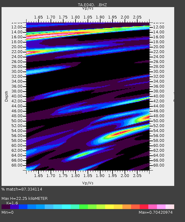
E04D Cinebar, WA, USA - Earthquake Result Viewer

Earthquake location: Off East Coast Of Honshu, Japan
Earthquake latitude/longitude: 39.6/143.2
Earthquake time(UTC): 2012/05/20 (141) 07:20:36 GMT
Earthquake Depth: 11 km
Earthquake Magnitude: 5.9 MB, 6.2 MS, 6.3 MW, 6.3 MW
Earthquake Catalog/Contributor: WHDF/NEIC
Network: TA USArray Transportable Network (new EarthScope stations)
Station: E04D Cinebar, WA, USA
Lat/Lon: 46.56 N/122.57 W
Elevation: 204 m
Distance: 65.1 deg
Az: 49.322 deg
Baz: 301.947 deg
Ray Param: 0.058460377
Estimated Moho Depth: 22.25 km
Estimated Crust Vp/Vs: 1.60
Assumed Crust Vp: 6.566 km/s
Estimated Crust Vs: 4.104 km/s
Estimated Crust Poisson's Ratio: 0.18
Radial Match: 87.334114 %
Radial Bump: 359
Transverse Match: 75.240326 %
Transverse Bump: 400
SOD ConfigId: 446234
Insert Time: 2012-08-25 18:54:22.095 +0000
GWidth: 2.5
Max Bumps: 400
Tol: 0.001

Signal To Noise

ChannelStoNSTALTA
TA:E04D: :BHZ:20120520T07:30:46.575017Z0.846130554.9254237E-75.821115E-7
TA:E04D: :BHN:20120520T07:30:46.575017Z1.2002163.2648506E-72.720219E-7
TA:E04D: :BHE:20120520T07:30:46.575017Z0.809457242.1471979E-72.652639E-7
Arrivals
Ps2.1 SECOND
PpPs8.4 SECOND
PsPs/PpSs11 SECOND