You are here: Home > Network List > TA - USArray Transportable Network (new EarthScope stations) Stations List
> Station D36A Goodland, MN, USA > Earthquake Result Viewer
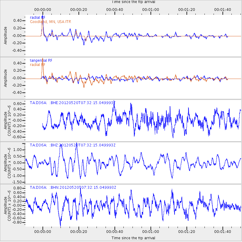
D36A Goodland, MN, USA - Earthquake Result Viewer
*The percent match for this event was below the threshold and hence no stack was calculated.
| Earthquake location: |
Off East Coast Of Honshu, Japan |
| Earthquake latitude/longitude: |
39.6/143.2 |
| Earthquake time(UTC): |
2012/05/20 (141) 07:20:36 GMT |
| Earthquake Depth: |
11 km |
| Earthquake Magnitude: |
5.9 MB, 6.2 MS, 6.3 MW, 6.3 MW |
| Earthquake Catalog/Contributor: |
WHDF/NEIC |
|
| Network: |
TA USArray Transportable Network (new EarthScope stations) |
| Station: |
D36A Goodland, MN, USA |
| Lat/Lon: |
47.18 N/93.16 W |
| Elevation: |
434 m |
|
| Distance: |
80.1 deg |
| Az: |
35.197 deg |
| Baz: |
319.28 deg |
| Ray Param: |
$rayparam |
*The percent match for this event was below the threshold and hence was not used in the summary stack. |
|
| Radial Match: |
78.36383 % |
| Radial Bump: |
400 |
| Transverse Match: |
55.983227 % |
| Transverse Bump: |
400 |
| SOD ConfigId: |
446234 |
| Insert Time: |
2012-08-25 18:54:25.362 +0000 |
| GWidth: |
2.5 |
| Max Bumps: |
400 |
| Tol: |
0.001 |
|
Signal To Noise
| Channel | StoN | STA | LTA |
| TA:D36A: :BHZ:20120520T07:32:15.049993Z | 0.53758055 | 1.8799615E-7 | 3.4970788E-7 |
| TA:D36A: :BHN:20120520T07:32:15.049993Z | 1.0332927 | 1.7388302E-7 | 1.6828052E-7 |
| TA:D36A: :BHE:20120520T07:32:15.049993Z | 1.006643 | 1.7875949E-7 | 1.7757982E-7 |
| Arrivals |
| Ps | |
| PpPs | |
| PsPs/PpSs | |


