You are here: Home > Network List > WI - West Indies IPGP Network Stations List
> Station BIM Morne Bigot, Anses d'Arlets, Martinique > Earthquake Result Viewer
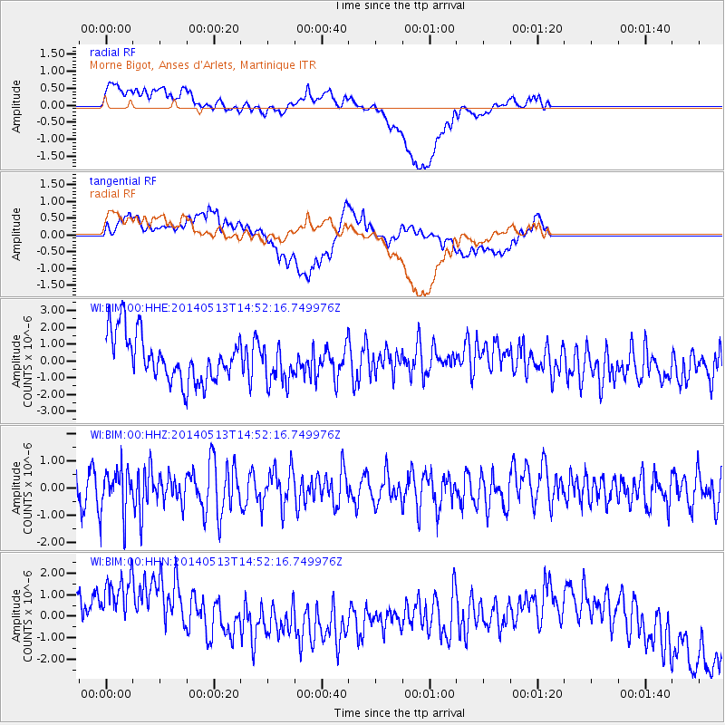
BIM Morne Bigot, Anses d'Arlets, Martinique - Earthquake Result Viewer
*The percent match for this event was below the threshold and hence no stack was calculated.
| Earthquake location: |
South Sandwich Islands Region |
| Earthquake latitude/longitude: |
-56.9/-25.2 |
| Earthquake time(UTC): |
2014/05/13 (133) 14:40:55 GMT |
| Earthquake Depth: |
20 km |
| Earthquake Magnitude: |
5.5 MW |
| Earthquake Catalog/Contributor: |
ISC/ISC |
|
| Network: |
WI West Indies IPGP Network |
| Station: |
BIM Morne Bigot, Anses d'Arlets, Martinique |
| Lat/Lon: |
14.52 N/61.07 W |
| Elevation: |
391 m |
|
| Distance: |
77.2 deg |
| Az: |
324.418 deg |
| Baz: |
160.777 deg |
| Ray Param: |
$rayparam |
*The percent match for this event was below the threshold and hence was not used in the summary stack. |
|
| Radial Match: |
59.38747 % |
| Radial Bump: |
400 |
| Transverse Match: |
71.283226 % |
| Transverse Bump: |
400 |
| SOD ConfigId: |
3390531 |
| Insert Time: |
2019-04-11 20:49:40.976 +0000 |
| GWidth: |
2.5 |
| Max Bumps: |
400 |
| Tol: |
0.001 |
|
Signal To Noise
| Channel | StoN | STA | LTA |
| WI:BIM:00:HHZ:20140513T14:52:16.749976Z | 1.5097027 | 8.0485245E-7 | 5.331198E-7 |
| WI:BIM:00:HHN:20140513T14:52:16.749976Z | 1.8836337 | 3.0086828E-6 | 1.5972759E-6 |
| WI:BIM:00:HHE:20140513T14:52:16.749976Z | 0.8358835 | 1.1637483E-6 | 1.3922374E-6 |
| Arrivals |
| Ps | |
| PpPs | |
| PsPs/PpSs | |


