You are here: Home > Network List > TA - USArray Transportable Network (new EarthScope stations) Stations List
> Station O37A Wolven Farm, McFall, MO, USA > Earthquake Result Viewer
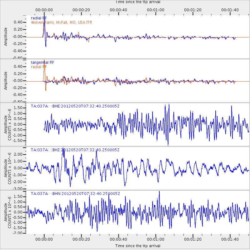
O37A Wolven Farm, McFall, MO, USA - Earthquake Result Viewer
*The percent match for this event was below the threshold and hence no stack was calculated.
| Earthquake location: |
Off East Coast Of Honshu, Japan |
| Earthquake latitude/longitude: |
39.6/143.2 |
| Earthquake time(UTC): |
2012/05/20 (141) 07:20:36 GMT |
| Earthquake Depth: |
11 km |
| Earthquake Magnitude: |
5.9 MB, 6.2 MS, 6.3 MW, 6.3 MW |
| Earthquake Catalog/Contributor: |
WHDF/NEIC |
|
| Network: |
TA USArray Transportable Network (new EarthScope stations) |
| Station: |
O37A Wolven Farm, McFall, MO, USA |
| Lat/Lon: |
40.17 N/94.15 W |
| Elevation: |
284 m |
|
| Distance: |
84.9 deg |
| Az: |
40.352 deg |
| Baz: |
319.279 deg |
| Ray Param: |
$rayparam |
*The percent match for this event was below the threshold and hence was not used in the summary stack. |
|
| Radial Match: |
78.10727 % |
| Radial Bump: |
400 |
| Transverse Match: |
57.011852 % |
| Transverse Bump: |
400 |
| SOD ConfigId: |
446234 |
| Insert Time: |
2012-08-25 18:55:07.033 +0000 |
| GWidth: |
2.5 |
| Max Bumps: |
400 |
| Tol: |
0.001 |
|
Signal To Noise
| Channel | StoN | STA | LTA |
| TA:O37A: :BHZ:20120520T07:32:40.250005Z | 0.64806783 | 3.4103152E-7 | 5.262282E-7 |
| TA:O37A: :BHN:20120520T07:32:40.250005Z | 1.4940215 | 4.5308875E-7 | 3.0326788E-7 |
| TA:O37A: :BHE:20120520T07:32:40.250005Z | 1.1047254 | 3.4306473E-7 | 3.10543E-7 |
| Arrivals |
| Ps | |
| PpPs | |
| PsPs/PpSs | |


