You are here: Home > Network List > TA - USArray Transportable Network (new EarthScope stations) Stations List
> Station Z43A Armstrong Family, Eudora, AR, USA > Earthquake Result Viewer
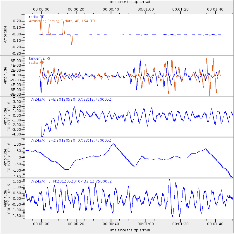
Z43A Armstrong Family, Eudora, AR, USA - Earthquake Result Viewer
*The percent match for this event was below the threshold and hence no stack was calculated.
| Earthquake location: |
Off East Coast Of Honshu, Japan |
| Earthquake latitude/longitude: |
39.6/143.2 |
| Earthquake time(UTC): |
2012/05/20 (141) 07:20:36 GMT |
| Earthquake Depth: |
11 km |
| Earthquake Magnitude: |
5.9 MB, 6.2 MS, 6.3 MW, 6.3 MW |
| Earthquake Catalog/Contributor: |
WHDF/NEIC |
|
| Network: |
TA USArray Transportable Network (new EarthScope stations) |
| Station: |
Z43A Armstrong Family, Eudora, AR, USA |
| Lat/Lon: |
33.21 N/91.24 W |
| Elevation: |
39 m |
|
| Distance: |
91.7 deg |
| Az: |
43.004 deg |
| Baz: |
321.086 deg |
| Ray Param: |
$rayparam |
*The percent match for this event was below the threshold and hence was not used in the summary stack. |
|
| Radial Match: |
59.54265 % |
| Radial Bump: |
400 |
| Transverse Match: |
53.213608 % |
| Transverse Bump: |
400 |
| SOD ConfigId: |
446234 |
| Insert Time: |
2012-08-25 18:55:40.798 +0000 |
| GWidth: |
2.5 |
| Max Bumps: |
400 |
| Tol: |
0.001 |
|
Signal To Noise
| Channel | StoN | STA | LTA |
| TA:Z43A: :BHZ:20120520T07:33:12.750005Z | 0.64209425 | 6.0484257E-5 | 9.419842E-5 |
| TA:Z43A: :BHN:20120520T07:33:12.750005Z | 1.5657313 | 6.324337E-7 | 4.0392226E-7 |
| TA:Z43A: :BHE:20120520T07:33:12.750005Z | 0.7428813 | 1.1766057E-6 | 1.5838408E-6 |
| Arrivals |
| Ps | |
| PpPs | |
| PsPs/PpSs | |


