You are here: Home > Network List > TA - USArray Transportable Network (new EarthScope stations) Stations List
> Station C38A Sawbill Landing (USFS), Superior Nat. Forest, MN, > Earthquake Result Viewer
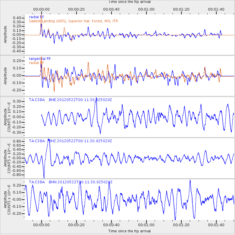
C38A Sawbill Landing (USFS), Superior Nat. Forest, MN, - Earthquake Result Viewer
*The percent match for this event was below the threshold and hence no stack was calculated.
| Earthquake location: |
Bulgaria |
| Earthquake latitude/longitude: |
42.6/23.0 |
| Earthquake time(UTC): |
2012/05/22 (143) 00:00:32 GMT |
| Earthquake Depth: |
10 km |
| Earthquake Magnitude: |
5.7 MB, 5.3 MS, 5.6 MW, 5.5 MW |
| Earthquake Catalog/Contributor: |
WHDF/NEIC |
|
| Network: |
TA USArray Transportable Network (new EarthScope stations) |
| Station: |
C38A Sawbill Landing (USFS), Superior Nat. Forest, MN, |
| Lat/Lon: |
47.72 N/91.27 W |
| Elevation: |
498 m |
|
| Distance: |
72.9 deg |
| Az: |
319.906 deg |
| Baz: |
44.726 deg |
| Ray Param: |
$rayparam |
*The percent match for this event was below the threshold and hence was not used in the summary stack. |
|
| Radial Match: |
56.579033 % |
| Radial Bump: |
400 |
| Transverse Match: |
59.589684 % |
| Transverse Bump: |
400 |
| SOD ConfigId: |
446234 |
| Insert Time: |
2012-08-25 19:25:19.229 +0000 |
| GWidth: |
2.5 |
| Max Bumps: |
400 |
| Tol: |
0.001 |
|
Signal To Noise
| Channel | StoN | STA | LTA |
| TA:C38A: :BHZ:20120522T00:11:30.925029Z | 3.8562057 | 5.306745E-7 | 1.3761571E-7 |
| TA:C38A: :BHN:20120522T00:11:30.925029Z | 1.0647143 | 1.108146E-7 | 1.04079184E-7 |
| TA:C38A: :BHE:20120522T00:11:30.925029Z | 2.633638 | 1.986533E-7 | 7.5429234E-8 |
| Arrivals |
| Ps | |
| PpPs | |
| PsPs/PpSs | |


