You are here: Home > Network List > TA - USArray Transportable Network (new EarthScope stations) Stations List
> Station 833A Chaparral WMA, Artesia Wells, TX, USA > Earthquake Result Viewer
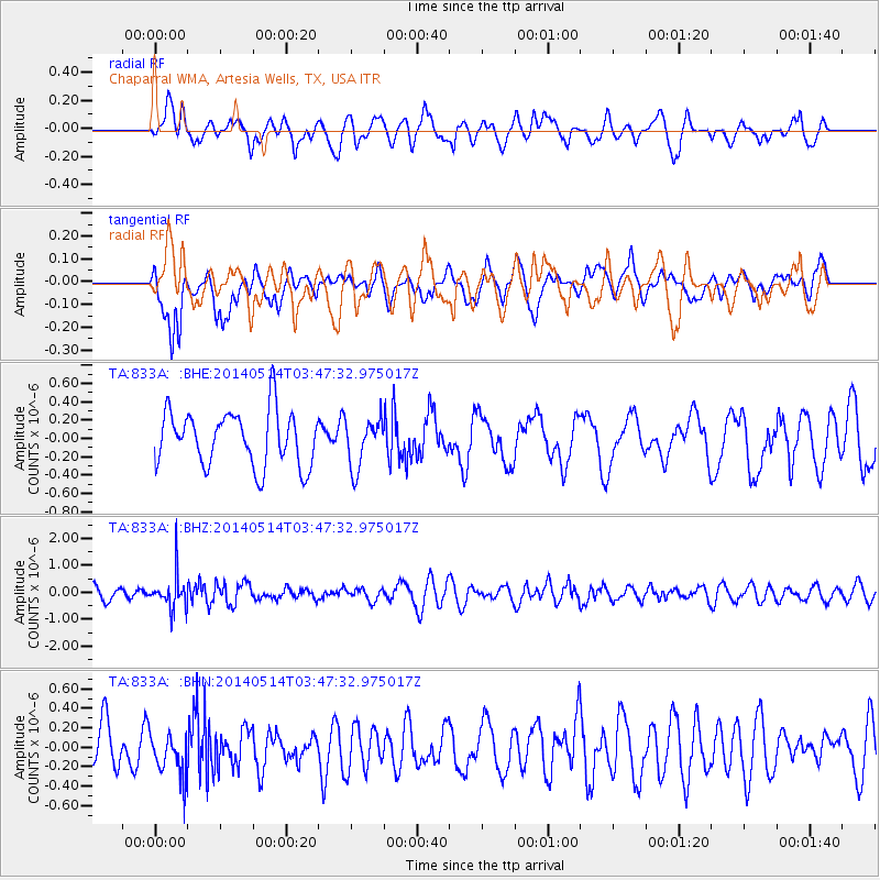
833A Chaparral WMA, Artesia Wells, TX, USA - Earthquake Result Viewer
*The percent match for this event was below the threshold and hence no stack was calculated.
| Earthquake location: |
Jujuy Province, Argentina |
| Earthquake latitude/longitude: |
-22.7/-66.6 |
| Earthquake time(UTC): |
2014/05/14 (134) 03:38:22 GMT |
| Earthquake Depth: |
223 km |
| Earthquake Magnitude: |
5.6 MW |
| Earthquake Catalog/Contributor: |
ISC/ISC |
|
| Network: |
TA USArray Transportable Network (new EarthScope stations) |
| Station: |
833A Chaparral WMA, Artesia Wells, TX, USA |
| Lat/Lon: |
28.32 N/99.39 W |
| Elevation: |
171 m |
|
| Distance: |
59.8 deg |
| Az: |
326.454 deg |
| Baz: |
144.642 deg |
| Ray Param: |
$rayparam |
*The percent match for this event was below the threshold and hence was not used in the summary stack. |
|
| Radial Match: |
61.31837 % |
| Radial Bump: |
400 |
| Transverse Match: |
58.65927 % |
| Transverse Bump: |
400 |
| SOD ConfigId: |
3390531 |
| Insert Time: |
2019-04-11 21:00:06.749 +0000 |
| GWidth: |
2.5 |
| Max Bumps: |
400 |
| Tol: |
0.001 |
|
Signal To Noise
| Channel | StoN | STA | LTA |
| TA:833A: :BHZ:20140514T03:47:32.975017Z | 2.8592334 | 6.300481E-7 | 2.2035559E-7 |
| TA:833A: :BHN:20140514T03:47:32.975017Z | 0.9959969 | 2.2509616E-7 | 2.2600086E-7 |
| TA:833A: :BHE:20140514T03:47:32.975017Z | 0.8860423 | 2.6601467E-7 | 3.0022792E-7 |
| Arrivals |
| Ps | |
| PpPs | |
| PsPs/PpSs | |


