You are here: Home > Network List > TA - USArray Transportable Network (new EarthScope stations) Stations List
> Station MSTX Muleshoe, TX, USA > Earthquake Result Viewer
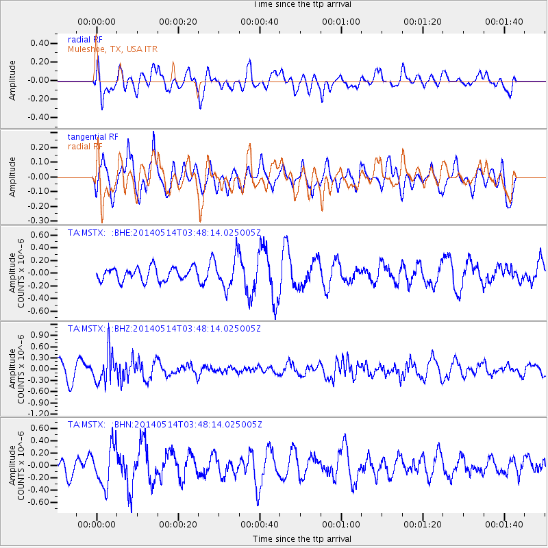
MSTX Muleshoe, TX, USA - Earthquake Result Viewer
*The percent match for this event was below the threshold and hence no stack was calculated.
| Earthquake location: |
Jujuy Province, Argentina |
| Earthquake latitude/longitude: |
-22.7/-66.6 |
| Earthquake time(UTC): |
2014/05/14 (134) 03:38:22 GMT |
| Earthquake Depth: |
223 km |
| Earthquake Magnitude: |
5.6 MW |
| Earthquake Catalog/Contributor: |
ISC/ISC |
|
| Network: |
TA USArray Transportable Network (new EarthScope stations) |
| Station: |
MSTX Muleshoe, TX, USA |
| Lat/Lon: |
33.97 N/102.77 W |
| Elevation: |
1167 m |
|
| Distance: |
66.1 deg |
| Az: |
327.533 deg |
| Baz: |
143.392 deg |
| Ray Param: |
$rayparam |
*The percent match for this event was below the threshold and hence was not used in the summary stack. |
|
| Radial Match: |
54.47216 % |
| Radial Bump: |
400 |
| Transverse Match: |
75.41495 % |
| Transverse Bump: |
400 |
| SOD ConfigId: |
3390531 |
| Insert Time: |
2019-04-11 21:00:46.910 +0000 |
| GWidth: |
2.5 |
| Max Bumps: |
400 |
| Tol: |
0.001 |
|
Signal To Noise
| Channel | StoN | STA | LTA |
| TA:MSTX: :BHZ:20140514T03:48:14.025005Z | 2.2785144 | 4.2743767E-7 | 1.8759488E-7 |
| TA:MSTX: :BHN:20140514T03:48:14.025005Z | 1.8165361 | 3.3021178E-7 | 1.8178103E-7 |
| TA:MSTX: :BHE:20140514T03:48:14.025005Z | 2.322846 | 2.4113803E-7 | 1.0381145E-7 |
| Arrivals |
| Ps | |
| PpPs | |
| PsPs/PpSs | |


