You are here: Home > Network List > TA - USArray Transportable Network (new EarthScope stations) Stations List
> Station R55A Marlinton, WV, USA > Earthquake Result Viewer
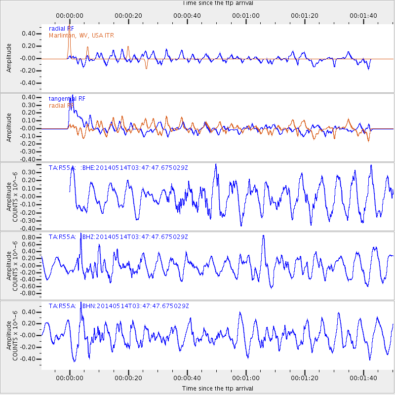
R55A Marlinton, WV, USA - Earthquake Result Viewer
*The percent match for this event was below the threshold and hence no stack was calculated.
| Earthquake location: |
Jujuy Province, Argentina |
| Earthquake latitude/longitude: |
-22.7/-66.6 |
| Earthquake time(UTC): |
2014/05/14 (134) 03:38:22 GMT |
| Earthquake Depth: |
223 km |
| Earthquake Magnitude: |
5.6 MW |
| Earthquake Catalog/Contributor: |
ISC/ISC |
|
| Network: |
TA USArray Transportable Network (new EarthScope stations) |
| Station: |
R55A Marlinton, WV, USA |
| Lat/Lon: |
38.28 N/80.12 W |
| Elevation: |
833 m |
|
| Distance: |
62.0 deg |
| Az: |
347.96 deg |
| Baz: |
165.836 deg |
| Ray Param: |
$rayparam |
*The percent match for this event was below the threshold and hence was not used in the summary stack. |
|
| Radial Match: |
48.02151 % |
| Radial Bump: |
400 |
| Transverse Match: |
66.83844 % |
| Transverse Bump: |
400 |
| SOD ConfigId: |
3390531 |
| Insert Time: |
2019-04-11 21:00:59.721 +0000 |
| GWidth: |
2.5 |
| Max Bumps: |
400 |
| Tol: |
0.001 |
|
Signal To Noise
| Channel | StoN | STA | LTA |
| TA:R55A: :BHZ:20140514T03:47:47.675029Z | 1.3668594 | 2.7041756E-7 | 1.9783862E-7 |
| TA:R55A: :BHN:20140514T03:47:47.675029Z | 2.07522 | 2.9957894E-7 | 1.4436009E-7 |
| TA:R55A: :BHE:20140514T03:47:47.675029Z | 0.46121302 | 6.920261E-8 | 1.5004478E-7 |
| Arrivals |
| Ps | |
| PpPs | |
| PsPs/PpSs | |


