You are here: Home > Network List > PE - Penn State Network Stations List
> Station WRPS We R Penn State > Earthquake Result Viewer
WRPS We R Penn State - Earthquake Result Viewer

| Earthquake location: |
Hokkaido, Japan Region |
| Earthquake latitude/longitude: |
41.3/142.1 |
| Earthquake time(UTC): |
2012/05/23 (144) 15:02:25 GMT |
| Earthquake Depth: |
46 km |
| Earthquake Magnitude: |
6.2 MB, 5.5 MS, 5.9 MW, 6.0 MW |
| Earthquake Catalog/Contributor: |
WHDF/NEIC |
|
| Network: |
PE Penn State Network |
| Station: |
WRPS We R Penn State |
| Lat/Lon: |
40.79 N/77.87 W |
| Elevation: |
320 m |
|
| Distance: |
90.6 deg |
| Az: |
29.177 deg |
| Baz: |
331.083 deg |
| Ray Param: |
0.041656453 |
| Estimated Moho Depth: |
42.75 km |
| Estimated Crust Vp/Vs: |
1.82 |
| Assumed Crust Vp: |
6.121 km/s |
| Estimated Crust Vs: |
3.372 km/s |
| Estimated Crust Poisson's Ratio: |
0.28 |
|
| Radial Match: |
80.607185 % |
| Radial Bump: |
354 |
| Transverse Match: |
59.803474 % |
| Transverse Bump: |
400 |
| SOD ConfigId: |
446234 |
| Insert Time: |
2012-08-25 20:15:27.815 +0000 |
| GWidth: |
2.5 |
| Max Bumps: |
400 |
| Tol: |
0.001 |
|
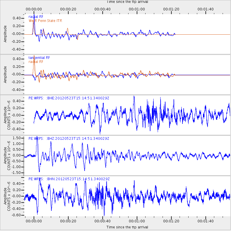
Signal To Noise
| Channel | StoN | STA | LTA |
| PE:WRPS: :BHZ:20120523T15:14:51.340029Z | 7.439076 | 7.6479125E-7 | 1.028073E-7 |
| PE:WRPS: :BHN:20120523T15:14:51.340029Z | 3.3137956 | 2.944224E-7 | 8.8847486E-8 |
| PE:WRPS: :BHE:20120523T15:14:51.340029Z | 2.5622382 | 1.8574234E-7 | 7.249222E-8 |
| Arrivals |
| Ps | 5.8 SECOND |
| PpPs | 19 SECOND |
| PsPs/PpSs | 25 SECOND |


