You are here: Home > Network List > G - GEOSCOPE Stations List
> Station PPTF Pamatai - Papeete - Tahiti island - French Polynesia, France > Earthquake Result Viewer
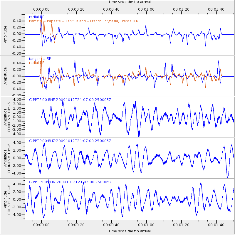
PPTF Pamatai - Papeete - Tahiti island - French Polynesia, France - Earthquake Result Viewer
*The percent match for this event was below the threshold and hence no stack was calculated.
| Earthquake location: |
Vanuatu Islands |
| Earthquake latitude/longitude: |
-14.1/166.3 |
| Earthquake time(UTC): |
2009/10/12 (285) 20:59:38 GMT |
| Earthquake Depth: |
35 km |
| Earthquake Magnitude: |
5.7 MW, 5.4 MS, 5.2 MB, 5.7 MW |
| Earthquake Catalog/Contributor: |
WHDF/NEIC |
|
| Network: |
G GEOSCOPE |
| Station: |
PPTF Pamatai - Papeete - Tahiti island - French Polynesia, France |
| Lat/Lon: |
17.59 S/149.57 W |
| Elevation: |
705 m |
|
| Distance: |
42.6 deg |
| Az: |
100.746 deg |
| Baz: |
268.18 deg |
| Ray Param: |
$rayparam |
*The percent match for this event was below the threshold and hence was not used in the summary stack. |
|
| Radial Match: |
67.7227 % |
| Radial Bump: |
400 |
| Transverse Match: |
67.5651 % |
| Transverse Bump: |
397 |
| SOD ConfigId: |
2622 |
| Insert Time: |
2010-02-26 23:43:34.445 +0000 |
| GWidth: |
2.5 |
| Max Bumps: |
400 |
| Tol: |
0.001 |
|
Signal To Noise
| Channel | StoN | STA | LTA |
| G:PPTF:00:BHZ:20091012T21:07:00.250005Z | 2.0627544 | 2.43139E-6 | 1.1787104E-6 |
| G:PPTF:00:BHN:20091012T21:07:00.250005Z | 2.2080948 | 3.243636E-6 | 1.4689749E-6 |
| G:PPTF:00:BHE:20091012T21:07:00.250005Z | 1.5761386 | 2.3056664E-6 | 1.4628577E-6 |
| Arrivals |
| Ps | |
| PpPs | |
| PsPs/PpSs | |


