You are here: Home > Network List > TA - USArray Transportable Network (new EarthScope stations) Stations List
> Station L41A Preston, IA, USA > Earthquake Result Viewer
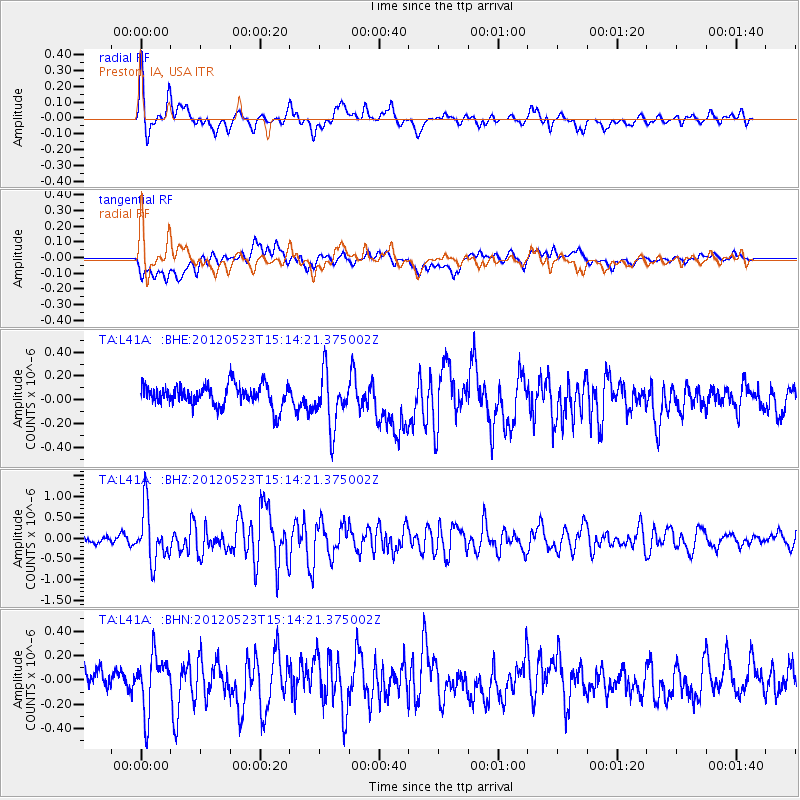
L41A Preston, IA, USA - Earthquake Result Viewer
*The percent match for this event was below the threshold and hence no stack was calculated.
| Earthquake location: |
Hokkaido, Japan Region |
| Earthquake latitude/longitude: |
41.3/142.1 |
| Earthquake time(UTC): |
2012/05/23 (144) 15:02:25 GMT |
| Earthquake Depth: |
46 km |
| Earthquake Magnitude: |
6.2 MB, 5.5 MS, 5.9 MW, 6.0 MW |
| Earthquake Catalog/Contributor: |
WHDF/NEIC |
|
| Network: |
TA USArray Transportable Network (new EarthScope stations) |
| Station: |
L41A Preston, IA, USA |
| Lat/Lon: |
42.08 N/90.50 W |
| Elevation: |
238 m |
|
| Distance: |
84.3 deg |
| Az: |
36.454 deg |
| Baz: |
323.058 deg |
| Ray Param: |
$rayparam |
*The percent match for this event was below the threshold and hence was not used in the summary stack. |
|
| Radial Match: |
75.59485 % |
| Radial Bump: |
352 |
| Transverse Match: |
59.44711 % |
| Transverse Bump: |
400 |
| SOD ConfigId: |
446234 |
| Insert Time: |
2012-08-25 20:33:03.577 +0000 |
| GWidth: |
2.5 |
| Max Bumps: |
400 |
| Tol: |
0.001 |
|
Signal To Noise
| Channel | StoN | STA | LTA |
| TA:L41A: :BHZ:20120523T15:14:21.375002Z | 5.1701527 | 6.3370896E-7 | 1.2257064E-7 |
| TA:L41A: :BHN:20120523T15:14:21.375002Z | 2.4785328 | 2.2554909E-7 | 9.100105E-8 |
| TA:L41A: :BHE:20120523T15:14:21.375002Z | 2.5161002 | 2.2411447E-7 | 8.907216E-8 |
| Arrivals |
| Ps | |
| PpPs | |
| PsPs/PpSs | |


