RER Riviere de l'Est, La Reunion (Indian Ocean) - Earthquake Result Viewer
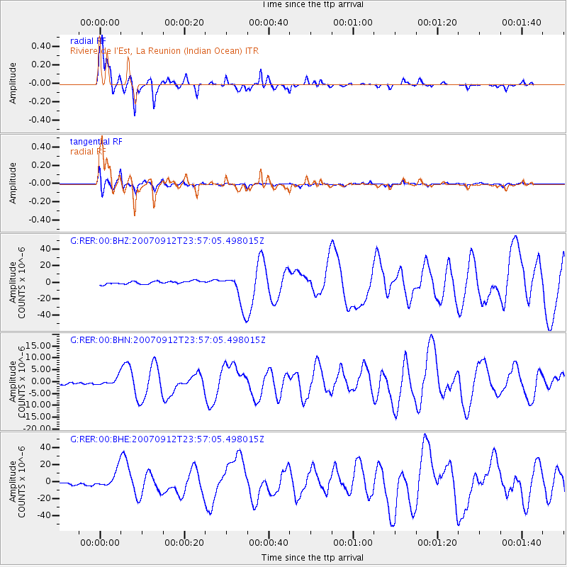
Earthquake location: Southern Sumatra, Indonesia
Earthquake latitude/longitude: -2.6/100.8
Earthquake time(UTC): 2007/09/12 (255) 23:49:03 GMT
Earthquake Depth: 35 km
Earthquake Magnitude: 6.6 MB, 8.1 MS, 7.9 MW, 7.6 ME
Earthquake Catalog/Contributor: WHDF/NEIC
Network: G GEOSCOPE
Station: RER Riviere de l'Est, La Reunion (Indian Ocean)
Lat/Lon: 21.16 S/55.75 E
Elevation: 834 m
Distance: 47.6 deg
Az: 243.577 deg
Baz: 73.424 deg
Ray Param: 0.069829166
Estimated Moho Depth: 12.75 km
Estimated Crust Vp/Vs: 1.60
Assumed Crust Vp: 4.73 km/s
Estimated Crust Vs: 2.956 km/s
Estimated Crust Poisson's Ratio: 0.18
Radial Match: 96.28781 %
Radial Bump: 326
Transverse Match: 91.43257 %
Transverse Bump: 400
SOD ConfigId: 2564
Insert Time: 2010-02-26 23:43:43.018 +0000
GWidth: 2.5
Max Bumps: 400
Tol: 0.001

Signal To Noise

ChannelStoNSTALTA
G:RER:00:BHN:20070912T23:57:05.498015Z3.65531951.8577666E-65.0823644E-7
G:RER:00:BHE:20070912T23:57:05.498015Z8.43791.16364E-51.3790635E-6
G:RER:00:BHZ:20070912T23:57:05.498015Z12.474632.1918278E-51.7570283E-6
Arrivals
Ps1.7 SECOND
PpPs6.8 SECOND
PsPs/PpSs8.4 SECOND