RER Riviere de l'Est, La Reunion (Indian Ocean) - Earthquake Result Viewer
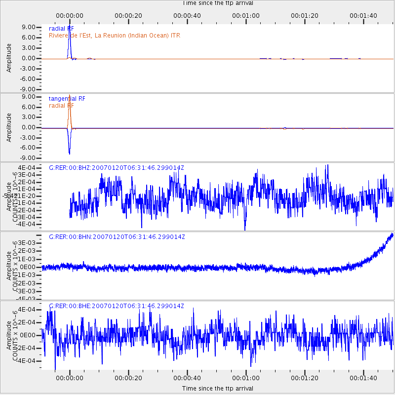
Earthquake location: South Sandwich Islands Region
Earthquake latitude/longitude: -55.4/-29.5
Earthquake time(UTC): 2007/01/20 (020) 06:21:04 GMT
Earthquake Depth: 10 km
Earthquake Magnitude: 5.7 MB, 6.2 MS, 6.2 MW, 6.1 MW
Earthquake Catalog/Contributor: WHDF/NEIC
Network: G GEOSCOPE
Station: RER Riviere de l'Est, La Reunion (Indian Ocean)
Lat/Lon: 21.16 S/55.75 E
Elevation: 834 m
Distance: 70.2 deg
Az: 98.649 deg
Baz: 217.149 deg
Ray Param: 0.05513571
Estimated Moho Depth: 69.75 km
Estimated Crust Vp/Vs: 2.08
Assumed Crust Vp: 4.73 km/s
Estimated Crust Vs: 2.277 km/s
Estimated Crust Poisson's Ratio: 0.35
Radial Match: 99.25388 %
Radial Bump: 42
Transverse Match: 99.266136 %
Transverse Bump: 42
SOD ConfigId: 2564
Insert Time: 2010-02-26 23:43:46.987 +0000
GWidth: 2.5
Max Bumps: 400
Tol: 0.001

Signal To Noise

ChannelStoNSTALTA
G:RER:00:BHN:20070120T06:31:46.299014Z1.17573444.738935E-104.0306164E-10
G:RER:00:BHE:20070120T06:31:46.299014Z0.860410631.3733119E-101.5961123E-10
G:RER:00:BHZ:20070120T06:31:46.299014Z0.966211141.4526641E-101.5034644E-10
Arrivals
Ps16 SECOND
PpPs45 SECOND
PsPs/PpSs61 SECOND