You are here: Home > Network List > TA - USArray Transportable Network (new EarthScope stations) Stations List
> Station R11A Troy Canyon, Currant, NV, USA > Earthquake Result Viewer
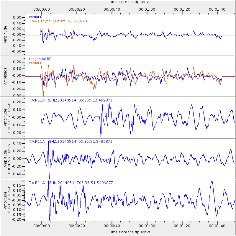
R11A Troy Canyon, Currant, NV, USA - Earthquake Result Viewer
*The percent match for this event was below the threshold and hence no stack was calculated.
| Earthquake location: |
South Of Panama |
| Earthquake latitude/longitude: |
7.6/-82.3 |
| Earthquake time(UTC): |
2014/05/14 (134) 05:28:25 GMT |
| Earthquake Depth: |
19 km |
| Earthquake Magnitude: |
5.3 MW |
| Earthquake Catalog/Contributor: |
ISC/ISC |
|
| Network: |
TA USArray Transportable Network (new EarthScope stations) |
| Station: |
R11A Troy Canyon, Currant, NV, USA |
| Lat/Lon: |
38.35 N/115.59 W |
| Elevation: |
1756 m |
|
| Distance: |
42.9 deg |
| Az: |
320.642 deg |
| Baz: |
126.915 deg |
| Ray Param: |
$rayparam |
*The percent match for this event was below the threshold and hence was not used in the summary stack. |
|
| Radial Match: |
58.850105 % |
| Radial Bump: |
400 |
| Transverse Match: |
41.41311 % |
| Transverse Bump: |
400 |
| SOD ConfigId: |
3390531 |
| Insert Time: |
2019-04-11 21:10:06.904 +0000 |
| GWidth: |
2.5 |
| Max Bumps: |
400 |
| Tol: |
0.001 |
|
Signal To Noise
| Channel | StoN | STA | LTA |
| TA:R11A: :BHZ:20140514T05:35:51.549987Z | 2.774988 | 2.1822636E-7 | 7.864047E-8 |
| TA:R11A: :BHN:20140514T05:35:51.549987Z | 2.6988444 | 8.749427E-8 | 3.2419162E-8 |
| TA:R11A: :BHE:20140514T05:35:51.549987Z | 1.3623728 | 8.4109914E-8 | 6.173781E-8 |
| Arrivals |
| Ps | |
| PpPs | |
| PsPs/PpSs | |


