You are here: Home > Network List > TA - USArray Transportable Network (new EarthScope stations) Stations List
> Station G59A Clarenceville, QC, USA > Earthquake Result Viewer
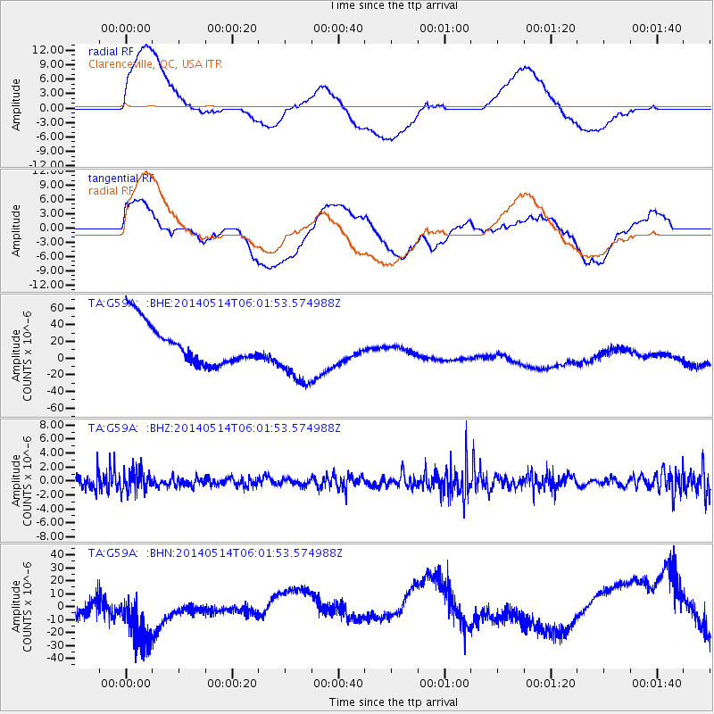
G59A Clarenceville, QC, USA - Earthquake Result Viewer
*The percent match for this event was below the threshold and hence no stack was calculated.
| Earthquake location: |
Near Coast Of Northern Chile |
| Earthquake latitude/longitude: |
-19.7/-71.0 |
| Earthquake time(UTC): |
2014/05/14 (134) 05:51:50 GMT |
| Earthquake Depth: |
27 km |
| Earthquake Magnitude: |
5.3 MW |
| Earthquake Catalog/Contributor: |
ISC/ISC |
|
| Network: |
TA USArray Transportable Network (new EarthScope stations) |
| Station: |
G59A Clarenceville, QC, USA |
| Lat/Lon: |
45.08 N/73.18 W |
| Elevation: |
36 m |
|
| Distance: |
64.5 deg |
| Az: |
358.255 deg |
| Baz: |
177.678 deg |
| Ray Param: |
$rayparam |
*The percent match for this event was below the threshold and hence was not used in the summary stack. |
|
| Radial Match: |
49.143852 % |
| Radial Bump: |
400 |
| Transverse Match: |
28.973228 % |
| Transverse Bump: |
400 |
| SOD ConfigId: |
3390531 |
| Insert Time: |
2019-04-11 21:16:43.026 +0000 |
| GWidth: |
2.5 |
| Max Bumps: |
400 |
| Tol: |
0.001 |
|
Signal To Noise
| Channel | StoN | STA | LTA |
| TA:G59A: :BHZ:20140514T06:01:53.574988Z | 1.0255384 | 1.418753E-6 | 1.3834225E-6 |
| TA:G59A: :BHN:20140514T06:01:53.574988Z | 2.2635844 | 2.868478E-5 | 1.2672282E-5 |
| TA:G59A: :BHE:20140514T06:01:53.574988Z | 1.5513401 | 3.736391E-5 | 2.4084922E-5 |
| Arrivals |
| Ps | |
| PpPs | |
| PsPs/PpSs | |


