You are here: Home > Network List > TA - USArray Transportable Network (new EarthScope stations) Stations List
> Station Q56A Snyder Ridge, Maysville, WV, USA > Earthquake Result Viewer
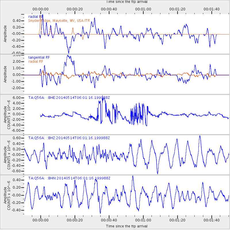
Q56A Snyder Ridge, Maysville, WV, USA - Earthquake Result Viewer
*The percent match for this event was below the threshold and hence no stack was calculated.
| Earthquake location: |
Near Coast Of Northern Chile |
| Earthquake latitude/longitude: |
-19.7/-71.0 |
| Earthquake time(UTC): |
2014/05/14 (134) 05:51:50 GMT |
| Earthquake Depth: |
27 km |
| Earthquake Magnitude: |
5.3 MW |
| Earthquake Catalog/Contributor: |
ISC/ISC |
|
| Network: |
TA USArray Transportable Network (new EarthScope stations) |
| Station: |
Q56A Snyder Ridge, Maysville, WV, USA |
| Lat/Lon: |
39.04 N/79.19 W |
| Elevation: |
430 m |
|
| Distance: |
58.9 deg |
| Az: |
352.522 deg |
| Baz: |
170.939 deg |
| Ray Param: |
$rayparam |
*The percent match for this event was below the threshold and hence was not used in the summary stack. |
|
| Radial Match: |
49.43958 % |
| Radial Bump: |
400 |
| Transverse Match: |
37.23074 % |
| Transverse Bump: |
400 |
| SOD ConfigId: |
3390531 |
| Insert Time: |
2019-04-11 21:17:17.991 +0000 |
| GWidth: |
2.5 |
| Max Bumps: |
400 |
| Tol: |
0.001 |
|
Signal To Noise
| Channel | StoN | STA | LTA |
| TA:Q56A: :BHZ:20140514T06:01:16.199988Z | 1.7787709 | 2.3771898E-7 | 1.3364227E-7 |
| TA:Q56A: :BHN:20140514T06:01:16.199988Z | 0.49596885 | 9.218123E-8 | 1.8586094E-7 |
| TA:Q56A: :BHE:20140514T06:01:16.199988Z | 4.147328 | 2.1697515E-6 | 5.231685E-7 |
| Arrivals |
| Ps | |
| PpPs | |
| PsPs/PpSs | |


