You are here: Home > Network List > G - GEOSCOPE Stations List
> Station RER Riviere de l'Est, La Reunion (Indian Ocean) > Earthquake Result Viewer
RER Riviere de l'Est, La Reunion (Indian Ocean) - Earthquake Result Viewer

| Earthquake location: |
Taiwan Region |
| Earthquake latitude/longitude: |
24.0/122.7 |
| Earthquake time(UTC): |
2001/12/18 (352) 04:02:58 GMT |
| Earthquake Depth: |
14 km |
| Earthquake Magnitude: |
6.3 MB, 7.3 MS, 6.9 MW, 6.8 MW |
| Earthquake Catalog/Contributor: |
WHDF/NEIC |
|
| Network: |
G GEOSCOPE |
| Station: |
RER Riviere de l'Est, La Reunion (Indian Ocean) |
| Lat/Lon: |
21.16 S/55.75 E |
| Elevation: |
834 m |
|
| Distance: |
79.1 deg |
| Az: |
241.03 deg |
| Baz: |
59.039 deg |
| Ray Param: |
0.049179208 |
| Estimated Moho Depth: |
11.25 km |
| Estimated Crust Vp/Vs: |
1.91 |
| Assumed Crust Vp: |
4.73 km/s |
| Estimated Crust Vs: |
2.48 km/s |
| Estimated Crust Poisson's Ratio: |
0.31 |
|
| Radial Match: |
88.70092 % |
| Radial Bump: |
400 |
| Transverse Match: |
75.5505 % |
| Transverse Bump: |
400 |
| SOD ConfigId: |
20082 |
| Insert Time: |
2010-02-26 23:44:18.796 +0000 |
| GWidth: |
2.5 |
| Max Bumps: |
400 |
| Tol: |
0.001 |
|
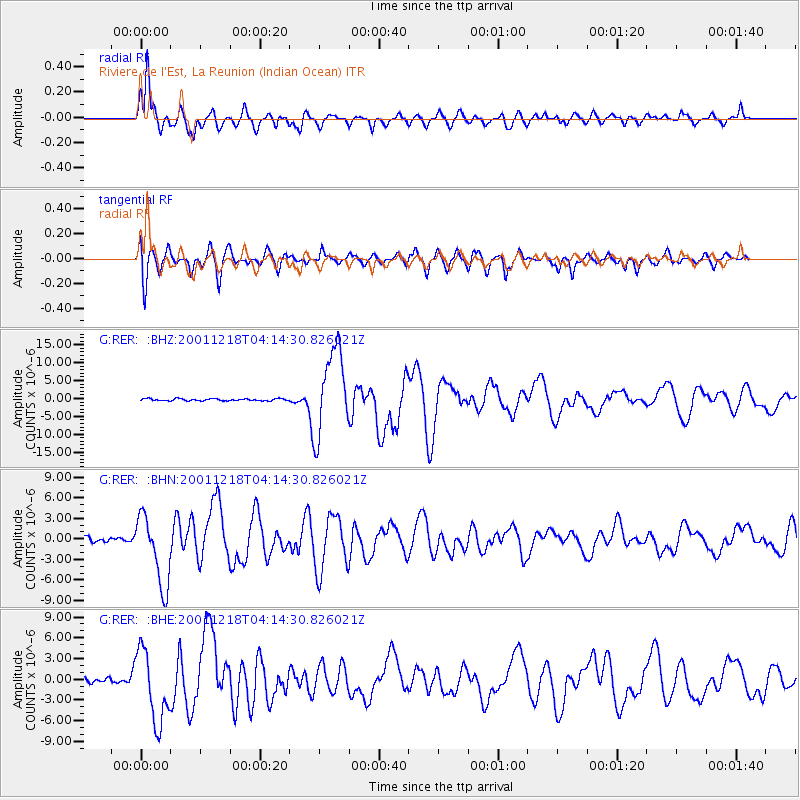
Signal To Noise
| Channel | StoN | STA | LTA |
| G:RER: :BHN:20011218T04:14:30.826021Z | 18.91173 | 5.1662064E-6 | 2.7317472E-7 |
| G:RER: :BHE:20011218T04:14:30.826021Z | 15.872325 | 5.255431E-6 | 3.3110655E-7 |
| G:RER: :BHZ:20011218T04:14:30.826021Z | 42.02726 | 1.1770079E-5 | 2.800582E-7 |
| Arrivals |
| Ps | 2.2 SECOND |
| PpPs | 6.8 SECOND |
| PsPs/PpSs | 9.0 SECOND |


