RER Riviere de l'Est, La Reunion (Indian Ocean) - Earthquake Result Viewer
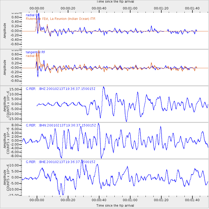
Earthquake location: Southern Sumatra, Indonesia
Earthquake latitude/longitude: -4.7/102.6
Earthquake time(UTC): 2001/02/13 (044) 19:28:30 GMT
Earthquake Depth: 36 km
Earthquake Magnitude: 6.2 MB, 7.2 MS, 7.4 MW, 7.0 ME
Earthquake Catalog/Contributor: WHDF/NEIC
Network: G GEOSCOPE
Station: RER Riviere de l'Est, La Reunion (Indian Ocean)
Lat/Lon: 21.16 S/55.75 E
Elevation: 834 m
Distance: 48.3 deg
Az: 245.798 deg
Baz: 76.9 deg
Ray Param: 0.06940272
Estimated Moho Depth: 12.0 km
Estimated Crust Vp/Vs: 1.79
Assumed Crust Vp: 4.73 km/s
Estimated Crust Vs: 2.639 km/s
Estimated Crust Poisson's Ratio: 0.27
Radial Match: 92.87885 %
Radial Bump: 400
Transverse Match: 79.31559 %
Transverse Bump: 400
SOD ConfigId: 3744
Insert Time: 2010-02-26 23:44:46.425 +0000
GWidth: 2.5
Max Bumps: 400
Tol: 0.001

Signal To Noise

ChannelStoNSTALTA
G:RER: :BHN:20010213T19:36:37.150015Z2.352381.8363284E-67.806257E-7
G:RER: :BHE:20010213T19:36:37.150015Z7.89048435.1355114E-66.508487E-7
G:RER: :BHZ:20010213T19:36:37.150015Z4.98006345.4234833E-61.089039E-6
Arrivals
Ps2.1 SECOND
PpPs6.9 SECOND
PsPs/PpSs8.9 SECOND