You are here: Home > Network List > TA - USArray Transportable Network (new EarthScope stations) Stations List
> Station V41A Mountainview, AR, USA > Earthquake Result Viewer
V41A Mountainview, AR, USA - Earthquake Result Viewer

| Earthquake location: |
Norwegian Sea |
| Earthquake latitude/longitude: |
73.0/5.7 |
| Earthquake time(UTC): |
2012/05/24 (145) 22:47:46 GMT |
| Earthquake Depth: |
10 km |
| Earthquake Magnitude: |
5.7 MB, 6.1 MS, 6.1 MW, 6.2 MW |
| Earthquake Catalog/Contributor: |
WHDF/NEIC |
|
| Network: |
TA USArray Transportable Network (new EarthScope stations) |
| Station: |
V41A Mountainview, AR, USA |
| Lat/Lon: |
35.79 N/92.16 W |
| Elevation: |
413 m |
|
| Distance: |
58.4 deg |
| Az: |
289.016 deg |
| Baz: |
20.05 deg |
| Ray Param: |
0.06285178 |
| Estimated Moho Depth: |
40.0 km |
| Estimated Crust Vp/Vs: |
1.80 |
| Assumed Crust Vp: |
6.498 km/s |
| Estimated Crust Vs: |
3.61 km/s |
| Estimated Crust Poisson's Ratio: |
0.28 |
|
| Radial Match: |
97.09768 % |
| Radial Bump: |
235 |
| Transverse Match: |
82.38944 % |
| Transverse Bump: |
400 |
| SOD ConfigId: |
446234 |
| Insert Time: |
2012-08-25 21:28:39.442 +0000 |
| GWidth: |
2.5 |
| Max Bumps: |
400 |
| Tol: |
0.001 |
|
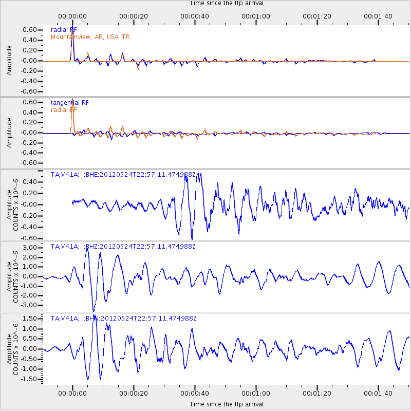
Signal To Noise
| Channel | StoN | STA | LTA |
| TA:V41A: :BHZ:20120524T22:57:11.474988Z | 20.973196 | 1.1703322E-6 | 5.5801326E-8 |
| TA:V41A: :BHN:20120524T22:57:11.474988Z | 7.447591 | 5.09576E-7 | 6.842159E-8 |
| TA:V41A: :BHE:20120524T22:57:11.474988Z | 3.987245 | 2.2009282E-7 | 5.519922E-8 |
| Arrivals |
| Ps | 5.2 SECOND |
| PpPs | 16 SECOND |
| PsPs/PpSs | 22 SECOND |


