You are here: Home > Network List > TA - USArray Transportable Network (new EarthScope stations) Stations List
> Station 353A Camilla, GA, USA > Earthquake Result Viewer
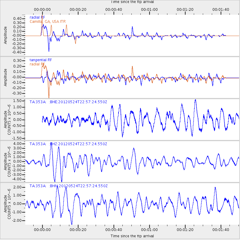
353A Camilla, GA, USA - Earthquake Result Viewer
*The percent match for this event was below the threshold and hence no stack was calculated.
| Earthquake location: |
Norwegian Sea |
| Earthquake latitude/longitude: |
73.0/5.7 |
| Earthquake time(UTC): |
2012/05/24 (145) 22:47:46 GMT |
| Earthquake Depth: |
10 km |
| Earthquake Magnitude: |
5.7 MB, 6.1 MS, 6.1 MW, 6.2 MW |
| Earthquake Catalog/Contributor: |
WHDF/NEIC |
|
| Network: |
TA USArray Transportable Network (new EarthScope stations) |
| Station: |
353A Camilla, GA, USA |
| Lat/Lon: |
31.35 N/84.22 W |
| Elevation: |
54 m |
|
| Distance: |
60.3 deg |
| Az: |
280.023 deg |
| Baz: |
19.838 deg |
| Ray Param: |
$rayparam |
*The percent match for this event was below the threshold and hence was not used in the summary stack. |
|
| Radial Match: |
88.42736 % |
| Radial Bump: |
400 |
| Transverse Match: |
80.926834 % |
| Transverse Bump: |
382 |
| SOD ConfigId: |
446234 |
| Insert Time: |
2012-08-25 21:41:49.967 +0000 |
| GWidth: |
2.5 |
| Max Bumps: |
400 |
| Tol: |
0.001 |
|
Signal To Noise
| Channel | StoN | STA | LTA |
| TA:353A: :BHZ:20120524T22:57:24.550Z | 5.7504845 | 1.3593937E-6 | 2.3639637E-7 |
| TA:353A: :BHN:20120524T22:57:24.550Z | 1.1579791 | 3.1175733E-7 | 2.6922535E-7 |
| TA:353A: :BHE:20120524T22:57:24.550Z | 1.510958 | 3.3015712E-7 | 2.1850848E-7 |
| Arrivals |
| Ps | |
| PpPs | |
| PsPs/PpSs | |


