You are here: Home > Network List > UW - Pacific Northwest Regional Seismic Network Stations List
> Station MRBL Marblemount, WA, USA > Earthquake Result Viewer
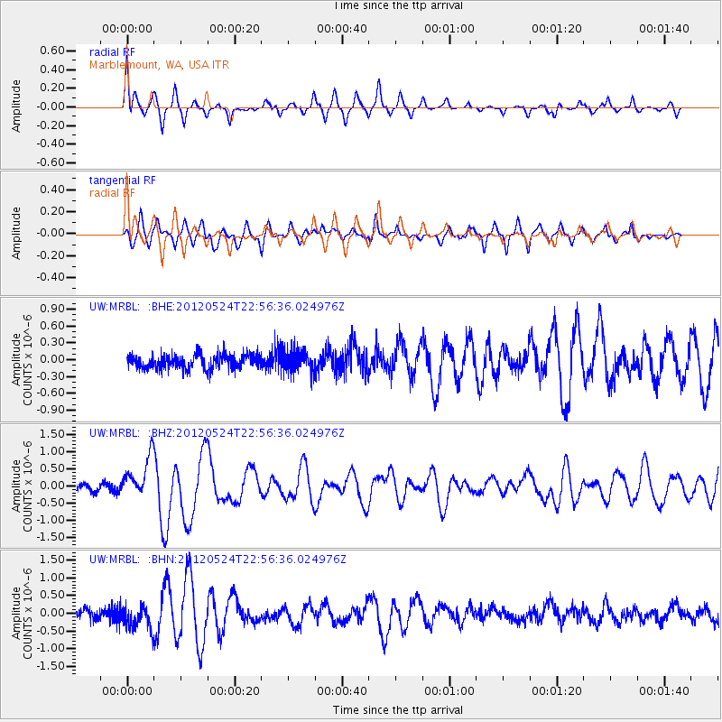
MRBL Marblemount, WA, USA - Earthquake Result Viewer
*The percent match for this event was below the threshold and hence no stack was calculated.
| Earthquake location: |
Norwegian Sea |
| Earthquake latitude/longitude: |
73.0/5.7 |
| Earthquake time(UTC): |
2012/05/24 (145) 22:47:46 GMT |
| Earthquake Depth: |
10 km |
| Earthquake Magnitude: |
5.7 MB, 6.1 MS, 6.1 MW, 6.2 MW |
| Earthquake Catalog/Contributor: |
WHDF/NEIC |
|
| Network: |
UW Pacific Northwest Regional Seismic Network |
| Station: |
MRBL Marblemount, WA, USA |
| Lat/Lon: |
48.52 N/121.48 W |
| Elevation: |
75 m |
|
| Distance: |
53.5 deg |
| Az: |
318.746 deg |
| Baz: |
17.003 deg |
| Ray Param: |
$rayparam |
*The percent match for this event was below the threshold and hence was not used in the summary stack. |
|
| Radial Match: |
71.014114 % |
| Radial Bump: |
299 |
| Transverse Match: |
71.640884 % |
| Transverse Bump: |
400 |
| SOD ConfigId: |
446234 |
| Insert Time: |
2012-08-25 21:45:21.142 +0000 |
| GWidth: |
2.5 |
| Max Bumps: |
400 |
| Tol: |
0.001 |
|
Signal To Noise
| Channel | StoN | STA | LTA |
| UW:MRBL: :BHZ:20120524T22:56:36.024976Z | 5.7674336 | 6.033362E-7 | 1.0461086E-7 |
| UW:MRBL: :BHN:20120524T22:56:36.024976Z | 2.5469668 | 3.3485688E-7 | 1.3147282E-7 |
| UW:MRBL: :BHE:20120524T22:56:36.024976Z | 1.5363129 | 1.895622E-7 | 1.2338775E-7 |
| Arrivals |
| Ps | |
| PpPs | |
| PsPs/PpSs | |


