You are here: Home > Network List > CI - Caltech Regional Seismic Network Stations List
> Station DAN Danby, California, USA > Earthquake Result Viewer
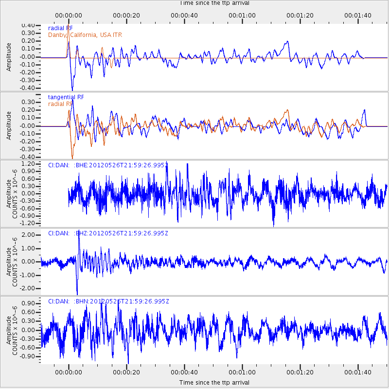
DAN Danby, California, USA - Earthquake Result Viewer
*The percent match for this event was below the threshold and hence no stack was calculated.
| Earthquake location: |
Bonin Islands, Japan Region |
| Earthquake latitude/longitude: |
26.9/140.1 |
| Earthquake time(UTC): |
2012/05/26 (147) 21:48:10 GMT |
| Earthquake Depth: |
487 km |
| Earthquake Magnitude: |
5.5 MB, 6.0 MW, 6.0 MW |
| Earthquake Catalog/Contributor: |
WHDF/NEIC |
|
| Network: |
CI Caltech Regional Seismic Network |
| Station: |
DAN Danby, California, USA |
| Lat/Lon: |
34.64 N/115.38 W |
| Elevation: |
398 m |
|
| Distance: |
86.0 deg |
| Az: |
53.129 deg |
| Baz: |
299.964 deg |
| Ray Param: |
$rayparam |
*The percent match for this event was below the threshold and hence was not used in the summary stack. |
|
| Radial Match: |
50.529713 % |
| Radial Bump: |
400 |
| Transverse Match: |
51.595577 % |
| Transverse Bump: |
400 |
| SOD ConfigId: |
446234 |
| Insert Time: |
2012-08-25 21:56:02.029 +0000 |
| GWidth: |
2.5 |
| Max Bumps: |
400 |
| Tol: |
0.001 |
|
Signal To Noise
| Channel | StoN | STA | LTA |
| CI:DAN: :BHZ:20120526T21:59:26.995Z | 2.8615992 | 8.437328E-7 | 2.948466E-7 |
| CI:DAN: :BHN:20120526T21:59:26.995Z | 1.0246086 | 4.0013705E-7 | 3.9052676E-7 |
| CI:DAN: :BHE:20120526T21:59:26.995Z | 1.452045 | 4.53118E-7 | 3.1205508E-7 |
| Arrivals |
| Ps | |
| PpPs | |
| PsPs/PpSs | |


