You are here: Home > Network List > IC - New China Digital Seismograph Network Stations List
> Station LSA Tibet, China > Earthquake Result Viewer
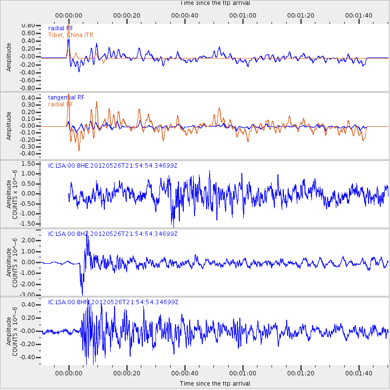
LSA Tibet, China - Earthquake Result Viewer
*The percent match for this event was below the threshold and hence no stack was calculated.
| Earthquake location: |
Bonin Islands, Japan Region |
| Earthquake latitude/longitude: |
26.9/140.1 |
| Earthquake time(UTC): |
2012/05/26 (147) 21:48:10 GMT |
| Earthquake Depth: |
487 km |
| Earthquake Magnitude: |
5.5 MB, 6.0 MW, 6.0 MW |
| Earthquake Catalog/Contributor: |
WHDF/NEIC |
|
| Network: |
IC New China Digital Seismograph Network |
| Station: |
LSA Tibet, China |
| Lat/Lon: |
29.70 N/91.13 E |
| Elevation: |
3660 m |
|
| Distance: |
42.9 deg |
| Az: |
285.58 deg |
| Baz: |
81.347 deg |
| Ray Param: |
$rayparam |
*The percent match for this event was below the threshold and hence was not used in the summary stack. |
|
| Radial Match: |
56.383408 % |
| Radial Bump: |
400 |
| Transverse Match: |
68.3723 % |
| Transverse Bump: |
400 |
| SOD ConfigId: |
446234 |
| Insert Time: |
2012-08-25 21:59:15.105 +0000 |
| GWidth: |
2.5 |
| Max Bumps: |
400 |
| Tol: |
0.001 |
|
Signal To Noise
| Channel | StoN | STA | LTA |
| IC:LSA:00:BHZ:20120526T21:54:54.34699Z | 11.78514 | 8.2660085E-7 | 7.013925E-8 |
| IC:LSA:00:BHN:20120526T21:54:54.34699Z | 2.4869125 | 5.7941346E-8 | 2.3298506E-8 |
| IC:LSA:00:BHE:20120526T21:54:54.34699Z | 1.5878147 | 4.550631E-7 | 2.865971E-7 |
| Arrivals |
| Ps | |
| PpPs | |
| PsPs/PpSs | |


