You are here: Home > Network List > KN - Kyrgyz Seismic Telemetry Network Stations List
> Station TKM2 - > Earthquake Result Viewer
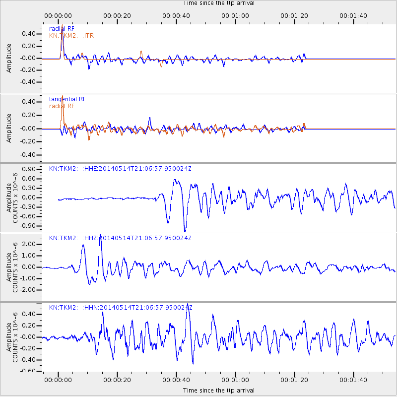
TKM2 - - Earthquake Result Viewer
*The percent match for this event was below the threshold and hence no stack was calculated.
| Earthquake location: |
E. Caroline Islands, Micronesia |
| Earthquake latitude/longitude: |
6.5/144.9 |
| Earthquake time(UTC): |
2014/05/14 (134) 20:56:13 GMT |
| Earthquake Depth: |
10 km |
| Earthquake Magnitude: |
6.1 MI |
| Earthquake Catalog/Contributor: |
NEIC PDE/NEIC ALERT |
|
| Network: |
KN Kyrgyz Seismic Telemetry Network |
| Station: |
TKM2 - |
| Lat/Lon: |
42.92 N/75.60 E |
| Elevation: |
2020 m |
|
| Distance: |
70.5 deg |
| Az: |
313.202 deg |
| Baz: |
99.556 deg |
| Ray Param: |
$rayparam |
*The percent match for this event was below the threshold and hence was not used in the summary stack. |
|
| Radial Match: |
91.988655 % |
| Radial Bump: |
400 |
| Transverse Match: |
83.84978 % |
| Transverse Bump: |
400 |
| SOD ConfigId: |
3390531 |
| Insert Time: |
2019-04-11 21:29:42.095 +0000 |
| GWidth: |
2.5 |
| Max Bumps: |
400 |
| Tol: |
0.001 |
|
Signal To Noise
| Channel | StoN | STA | LTA |
| KN:TKM2: :HHZ:20140514T21:06:57.950024Z | 2.246648 | 7.81503E-8 | 3.4785288E-8 |
| KN:TKM2: :HHN:20140514T21:06:57.950024Z | 0.5831447 | 1.6989059E-8 | 2.913352E-8 |
| KN:TKM2: :HHE:20140514T21:06:57.950024Z | 1.1205792 | 2.0092836E-8 | 1.7930759E-8 |
| Arrivals |
| Ps | |
| PpPs | |
| PsPs/PpSs | |


