You are here: Home > Network List > IW - Intermountain West Stations List
> Station MOOW Moose Ponds, Wyoming, USA > Earthquake Result Viewer
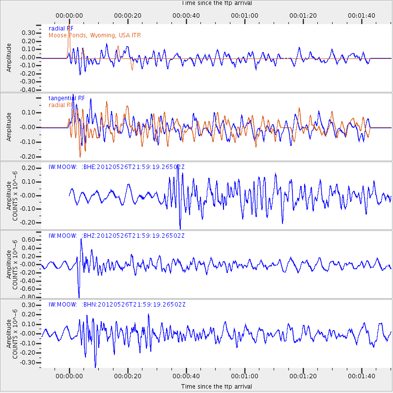
MOOW Moose Ponds, Wyoming, USA - Earthquake Result Viewer
*The percent match for this event was below the threshold and hence no stack was calculated.
| Earthquake location: |
Bonin Islands, Japan Region |
| Earthquake latitude/longitude: |
26.9/140.1 |
| Earthquake time(UTC): |
2012/05/26 (147) 21:48:10 GMT |
| Earthquake Depth: |
487 km |
| Earthquake Magnitude: |
5.5 MB, 6.0 MW, 6.0 MW |
| Earthquake Catalog/Contributor: |
WHDF/NEIC |
|
| Network: |
IW Intermountain West |
| Station: |
MOOW Moose Ponds, Wyoming, USA |
| Lat/Lon: |
43.75 N/110.74 W |
| Elevation: |
2128 m |
|
| Distance: |
84.4 deg |
| Az: |
43.445 deg |
| Baz: |
302.081 deg |
| Ray Param: |
$rayparam |
*The percent match for this event was below the threshold and hence was not used in the summary stack. |
|
| Radial Match: |
64.67234 % |
| Radial Bump: |
400 |
| Transverse Match: |
54.268547 % |
| Transverse Bump: |
400 |
| SOD ConfigId: |
446234 |
| Insert Time: |
2012-08-25 22:00:30.513 +0000 |
| GWidth: |
2.5 |
| Max Bumps: |
400 |
| Tol: |
0.001 |
|
Signal To Noise
| Channel | StoN | STA | LTA |
| IW:MOOW: :BHZ:20120526T21:59:19.26502Z | 4.6634345 | 2.8460224E-7 | 6.102846E-8 |
| IW:MOOW: :BHN:20120526T21:59:19.26502Z | 1.4837264 | 6.083866E-8 | 4.1003958E-8 |
| IW:MOOW: :BHE:20120526T21:59:19.26502Z | 1.4760967 | 5.1593574E-8 | 3.4952702E-8 |
| Arrivals |
| Ps | |
| PpPs | |
| PsPs/PpSs | |


