You are here: Home > Network List > TA - USArray Transportable Network (new EarthScope stations) Stations List
> Station J01E Myrtle Point, OR, USA > Earthquake Result Viewer
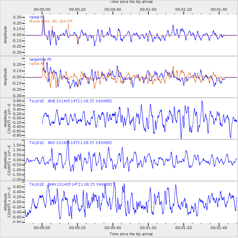
J01E Myrtle Point, OR, USA - Earthquake Result Viewer
*The percent match for this event was below the threshold and hence no stack was calculated.
| Earthquake location: |
E. Caroline Islands, Micronesia |
| Earthquake latitude/longitude: |
6.5/144.9 |
| Earthquake time(UTC): |
2014/05/14 (134) 20:56:13 GMT |
| Earthquake Depth: |
10 km |
| Earthquake Magnitude: |
6.1 MI |
| Earthquake Catalog/Contributor: |
NEIC PDE/NEIC ALERT |
|
| Network: |
TA USArray Transportable Network (new EarthScope stations) |
| Station: |
J01E Myrtle Point, OR, USA |
| Lat/Lon: |
43.16 N/123.93 W |
| Elevation: |
128 m |
|
| Distance: |
86.5 deg |
| Az: |
47.132 deg |
| Baz: |
275.51 deg |
| Ray Param: |
$rayparam |
*The percent match for this event was below the threshold and hence was not used in the summary stack. |
|
| Radial Match: |
63.59818 % |
| Radial Bump: |
400 |
| Transverse Match: |
40.49188 % |
| Transverse Bump: |
400 |
| SOD ConfigId: |
3390531 |
| Insert Time: |
2019-04-11 21:30:35.452 +0000 |
| GWidth: |
2.5 |
| Max Bumps: |
400 |
| Tol: |
0.001 |
|
Signal To Noise
| Channel | StoN | STA | LTA |
| TA:J01E: :BHZ:20140514T21:08:25.349988Z | 1.1617498 | 2.3866002E-7 | 2.0543152E-7 |
| TA:J01E: :BHN:20140514T21:08:25.349988Z | 0.89794344 | 2.994809E-7 | 3.3351864E-7 |
| TA:J01E: :BHE:20140514T21:08:25.349988Z | 1.2037535 | 2.0939378E-7 | 1.7395072E-7 |
| Arrivals |
| Ps | |
| PpPs | |
| PsPs/PpSs | |


