You are here: Home > Network List > TA - USArray Transportable Network (new EarthScope stations) Stations List
> Station H17A Grant Village (NPS), Yellowstone Nt. Park, WY, USA > Earthquake Result Viewer
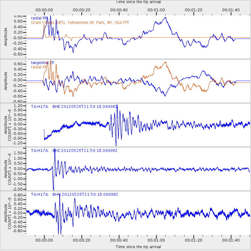
H17A Grant Village (NPS), Yellowstone Nt. Park, WY, USA - Earthquake Result Viewer
*The percent match for this event was below the threshold and hence no stack was calculated.
| Earthquake location: |
Bonin Islands, Japan Region |
| Earthquake latitude/longitude: |
26.9/140.1 |
| Earthquake time(UTC): |
2012/05/26 (147) 21:48:10 GMT |
| Earthquake Depth: |
487 km |
| Earthquake Magnitude: |
5.5 MB, 6.0 MW, 6.0 MW |
| Earthquake Catalog/Contributor: |
WHDF/NEIC |
|
| Network: |
TA USArray Transportable Network (new EarthScope stations) |
| Station: |
H17A Grant Village (NPS), Yellowstone Nt. Park, WY, USA |
| Lat/Lon: |
44.40 N/110.58 W |
| Elevation: |
2400 m |
|
| Distance: |
84.2 deg |
| Az: |
42.83 deg |
| Baz: |
302.137 deg |
| Ray Param: |
$rayparam |
*The percent match for this event was below the threshold and hence was not used in the summary stack. |
|
| Radial Match: |
54.454914 % |
| Radial Bump: |
400 |
| Transverse Match: |
49.311092 % |
| Transverse Bump: |
400 |
| SOD ConfigId: |
446234 |
| Insert Time: |
2012-08-25 22:05:03.563 +0000 |
| GWidth: |
2.5 |
| Max Bumps: |
400 |
| Tol: |
0.001 |
|
Signal To Noise
| Channel | StoN | STA | LTA |
| TA:H17A: :BHZ:20120526T21:59:18.09998Z | 5.6954694 | 3.6277856E-7 | 6.369599E-8 |
| TA:H17A: :BHN:20120526T21:59:18.09998Z | 0.9005442 | 6.269764E-8 | 6.962194E-8 |
| TA:H17A: :BHE:20120526T21:59:18.09998Z | 0.71431917 | 2.2565246E-7 | 3.1589863E-7 |
| Arrivals |
| Ps | |
| PpPs | |
| PsPs/PpSs | |


