You are here: Home > Network List > G - GEOSCOPE Stations List
> Station RER Riviere de l'Est, La Reunion (Indian Ocean) > Earthquake Result Viewer
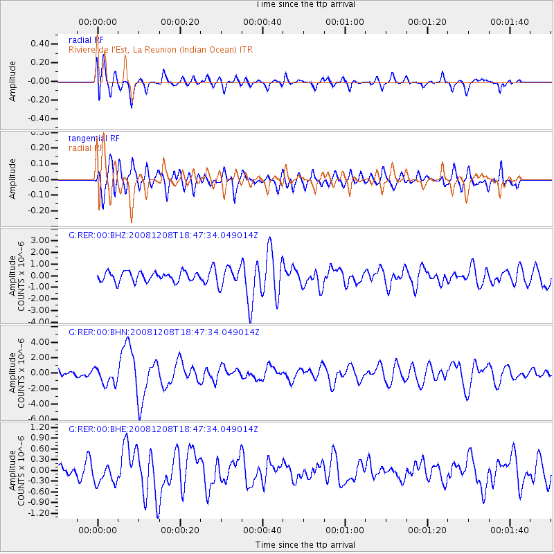
RER Riviere de l'Est, La Reunion (Indian Ocean) - Earthquake Result Viewer
*The percent match for this event was below the threshold and hence no stack was calculated.
| Earthquake location: |
Southeast Indian Ridge |
| Earthquake latitude/longitude: |
-53.0/106.8 |
| Earthquake time(UTC): |
2008/12/08 (343) 18:39:09 GMT |
| Earthquake Depth: |
10 km |
| Earthquake Magnitude: |
6.2 MB, 5.9 MS, 6.3 MW, 6.3 MW |
| Earthquake Catalog/Contributor: |
WHDF/NEIC |
|
| Network: |
G GEOSCOPE |
| Station: |
RER Riviere de l'Est, La Reunion (Indian Ocean) |
| Lat/Lon: |
21.16 S/55.75 E |
| Elevation: |
834 m |
|
| Distance: |
50.2 deg |
| Az: |
289.021 deg |
| Baz: |
142.258 deg |
| Ray Param: |
$rayparam |
*The percent match for this event was below the threshold and hence was not used in the summary stack. |
|
| Radial Match: |
58.615177 % |
| Radial Bump: |
400 |
| Transverse Match: |
54.843025 % |
| Transverse Bump: |
400 |
| SOD ConfigId: |
2658 |
| Insert Time: |
2010-02-26 23:45:54.578 +0000 |
| GWidth: |
2.5 |
| Max Bumps: |
400 |
| Tol: |
0.001 |
|
Signal To Noise
| Channel | StoN | STA | LTA |
| G:RER:00:BHN:20081208T18:47:34.049014Z | 2.5477211 | 1.126533E-6 | 4.421728E-7 |
| G:RER:00:BHE:20081208T18:47:34.049014Z | 1.6687461 | 2.8018314E-7 | 1.679004E-7 |
| G:RER:00:BHZ:20081208T18:47:34.049014Z | 1.8962519 | 7.635575E-7 | 4.0266673E-7 |
| Arrivals |
| Ps | |
| PpPs | |
| PsPs/PpSs | |


