You are here: Home > Network List > TA - USArray Transportable Network (new EarthScope stations) Stations List
> Station T25A Trinidad, CO, USA > Earthquake Result Viewer
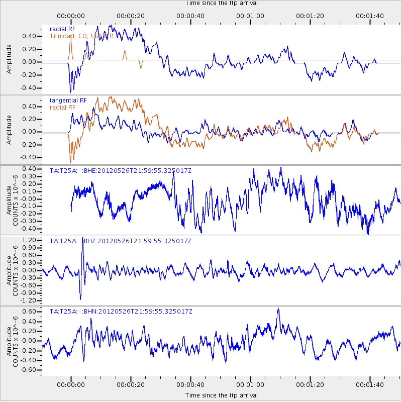
T25A Trinidad, CO, USA - Earthquake Result Viewer
*The percent match for this event was below the threshold and hence no stack was calculated.
| Earthquake location: |
Bonin Islands, Japan Region |
| Earthquake latitude/longitude: |
26.9/140.1 |
| Earthquake time(UTC): |
2012/05/26 (147) 21:48:10 GMT |
| Earthquake Depth: |
487 km |
| Earthquake Magnitude: |
5.5 MB, 6.0 MW, 6.0 MW |
| Earthquake Catalog/Contributor: |
WHDF/NEIC |
|
| Network: |
TA USArray Transportable Network (new EarthScope stations) |
| Station: |
T25A Trinidad, CO, USA |
| Lat/Lon: |
37.14 N/104.41 W |
| Elevation: |
2017 m |
|
| Distance: |
92.1 deg |
| Az: |
46.184 deg |
| Baz: |
306.266 deg |
| Ray Param: |
$rayparam |
*The percent match for this event was below the threshold and hence was not used in the summary stack. |
|
| Radial Match: |
53.65479 % |
| Radial Bump: |
400 |
| Transverse Match: |
67.5162 % |
| Transverse Bump: |
400 |
| SOD ConfigId: |
446234 |
| Insert Time: |
2012-08-25 22:05:14.781 +0000 |
| GWidth: |
2.5 |
| Max Bumps: |
400 |
| Tol: |
0.001 |
|
Signal To Noise
| Channel | StoN | STA | LTA |
| TA:T25A: :BHZ:20120526T21:59:55.325017Z | 4.9653096 | 4.679534E-7 | 9.4244555E-8 |
| TA:T25A: :BHN:20120526T21:59:55.325017Z | 1.8453348 | 2.1612878E-7 | 1.1712172E-7 |
| TA:T25A: :BHE:20120526T21:59:55.325017Z | 1.5137739 | 1.9607636E-7 | 1.2952817E-7 |
| Arrivals |
| Ps | |
| PpPs | |
| PsPs/PpSs | |


