You are here: Home > Network List > TA - USArray Transportable Network (new EarthScope stations) Stations List
> Station D36A Goodland, MN, USA > Earthquake Result Viewer
D36A Goodland, MN, USA - Earthquake Result Viewer
*The percent match for this event was below the threshold and hence no stack was calculated.
| Earthquake location: |
Bonin Islands, Japan Region |
| Earthquake latitude/longitude: |
26.9/140.1 |
| Earthquake time(UTC): |
2012/05/26 (147) 21:48:10 GMT |
| Earthquake Depth: |
487 km |
| Earthquake Magnitude: |
5.5 MB, 6.0 MW, 6.0 MW |
| Earthquake Catalog/Contributor: |
WHDF/NEIC |
|
| Network: |
TA USArray Transportable Network (new EarthScope stations) |
| Station: |
D36A Goodland, MN, USA |
| Lat/Lon: |
47.18 N/93.16 W |
| Elevation: |
434 m |
|
| Distance: |
92.0 deg |
| Az: |
33.144 deg |
| Baz: |
314.304 deg |
| Ray Param: |
$rayparam |
*The percent match for this event was below the threshold and hence was not used in the summary stack. |
|
| Radial Match: |
52.393703 % |
| Radial Bump: |
400 |
| Transverse Match: |
63.473213 % |
| Transverse Bump: |
400 |
| SOD ConfigId: |
446234 |
| Insert Time: |
2012-08-25 22:06:56.893 +0000 |
| GWidth: |
2.5 |
| Max Bumps: |
400 |
| Tol: |
0.001 |
|
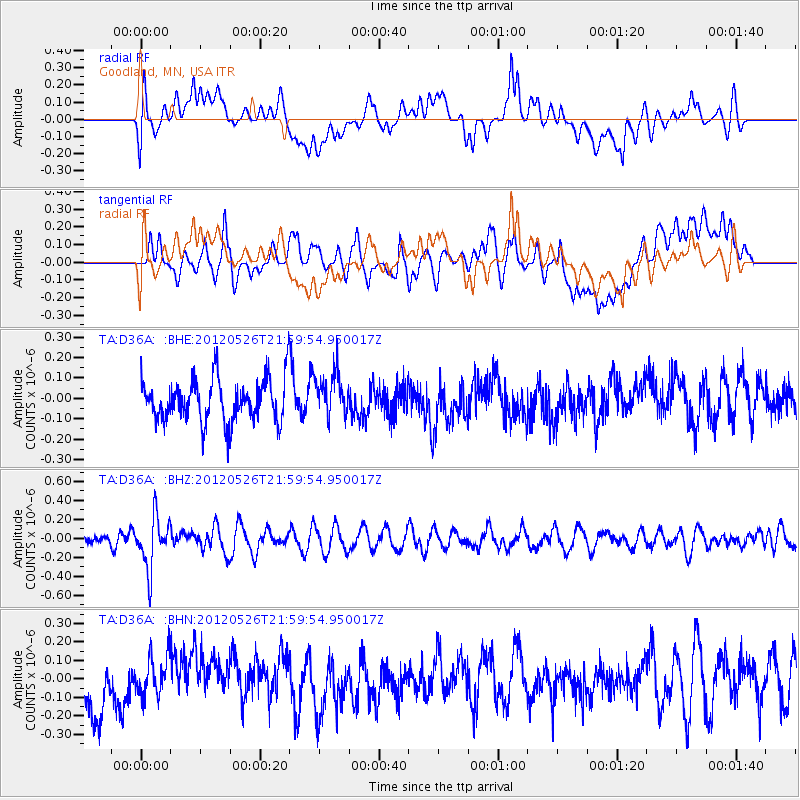
Signal To Noise
| Channel | StoN | STA | LTA |
| TA:D36A: :BHZ:20120526T21:59:54.950017Z | 2.9067166 | 2.756207E-7 | 9.4822006E-8 |
| TA:D36A: :BHN:20120526T21:59:54.950017Z | 0.7985526 | 1.07019446E-7 | 1.3401679E-7 |
| TA:D36A: :BHE:20120526T21:59:54.950017Z | 0.9857751 | 1.0288497E-7 | 1.0436962E-7 |
| Arrivals |
| Ps | |
| PpPs | |
| PsPs/PpSs | |


