You are here: Home > Network List > TA - USArray Transportable Network (new EarthScope stations) Stations List
> Station E36A McGregor, MN, USA > Earthquake Result Viewer
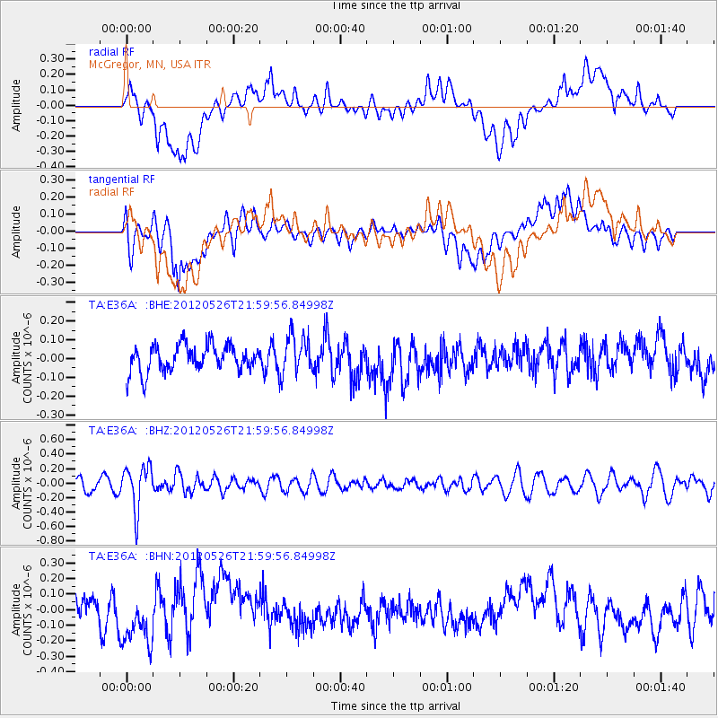
E36A McGregor, MN, USA - Earthquake Result Viewer
*The percent match for this event was below the threshold and hence no stack was calculated.
| Earthquake location: |
Bonin Islands, Japan Region |
| Earthquake latitude/longitude: |
26.9/140.1 |
| Earthquake time(UTC): |
2012/05/26 (147) 21:48:10 GMT |
| Earthquake Depth: |
487 km |
| Earthquake Magnitude: |
5.5 MB, 6.0 MW, 6.0 MW |
| Earthquake Catalog/Contributor: |
WHDF/NEIC |
|
| Network: |
TA USArray Transportable Network (new EarthScope stations) |
| Station: |
E36A McGregor, MN, USA |
| Lat/Lon: |
46.52 N/93.26 W |
| Elevation: |
393 m |
|
| Distance: |
92.5 deg |
| Az: |
33.66 deg |
| Baz: |
314.218 deg |
| Ray Param: |
$rayparam |
*The percent match for this event was below the threshold and hence was not used in the summary stack. |
|
| Radial Match: |
46.876545 % |
| Radial Bump: |
400 |
| Transverse Match: |
44.8509 % |
| Transverse Bump: |
400 |
| SOD ConfigId: |
446234 |
| Insert Time: |
2012-08-25 22:08:16.923 +0000 |
| GWidth: |
2.5 |
| Max Bumps: |
400 |
| Tol: |
0.001 |
|
Signal To Noise
| Channel | StoN | STA | LTA |
| TA:E36A: :BHZ:20120526T21:59:56.84998Z | 4.0385942 | 3.0206002E-7 | 7.4793356E-8 |
| TA:E36A: :BHN:20120526T21:59:56.84998Z | 1.9950608 | 1.6606364E-7 | 8.323738E-8 |
| TA:E36A: :BHE:20120526T21:59:56.84998Z | 1.4524117 | 1.0247834E-7 | 7.055736E-8 |
| Arrivals |
| Ps | |
| PpPs | |
| PsPs/PpSs | |


