You are here: Home > Network List > TA - USArray Transportable Network (new EarthScope stations) Stations List
> Station L39A Vinton, IA, USA > Earthquake Result Viewer
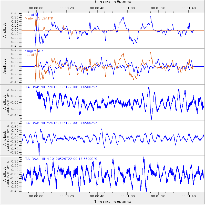
L39A Vinton, IA, USA - Earthquake Result Viewer
*The percent match for this event was below the threshold and hence no stack was calculated.
| Earthquake location: |
Bonin Islands, Japan Region |
| Earthquake latitude/longitude: |
26.9/140.1 |
| Earthquake time(UTC): |
2012/05/26 (147) 21:48:10 GMT |
| Earthquake Depth: |
487 km |
| Earthquake Magnitude: |
5.5 MB, 6.0 MW, 6.0 MW |
| Earthquake Catalog/Contributor: |
WHDF/NEIC |
|
| Network: |
TA USArray Transportable Network (new EarthScope stations) |
| Station: |
L39A Vinton, IA, USA |
| Lat/Lon: |
42.12 N/92.00 W |
| Elevation: |
261 m |
|
| Distance: |
96.2 deg |
| Az: |
36.164 deg |
| Baz: |
314.904 deg |
| Ray Param: |
$rayparam |
*The percent match for this event was below the threshold and hence was not used in the summary stack. |
|
| Radial Match: |
45.02975 % |
| Radial Bump: |
400 |
| Transverse Match: |
54.2551 % |
| Transverse Bump: |
400 |
| SOD ConfigId: |
446234 |
| Insert Time: |
2012-08-25 22:08:49.915 +0000 |
| GWidth: |
2.5 |
| Max Bumps: |
400 |
| Tol: |
0.001 |
|
Signal To Noise
| Channel | StoN | STA | LTA |
| TA:L39A: :BHZ:20120526T22:00:13.650029Z | 2.6354322 | 3.637854E-7 | 1.3803633E-7 |
| TA:L39A: :BHN:20120526T22:00:13.650029Z | 0.91066223 | 1.2825694E-7 | 1.408392E-7 |
| TA:L39A: :BHE:20120526T22:00:13.650029Z | 1.4052635 | 2.1822545E-7 | 1.5529147E-7 |
| Arrivals |
| Ps | |
| PpPs | |
| PsPs/PpSs | |


