You are here: Home > Network List > TA - USArray Transportable Network (new EarthScope stations) Stations List
> Station G43A Wallace, MI, USA > Earthquake Result Viewer
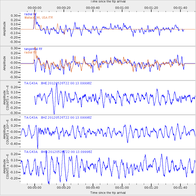
G43A Wallace, MI, USA - Earthquake Result Viewer
*The percent match for this event was below the threshold and hence no stack was calculated.
| Earthquake location: |
Bonin Islands, Japan Region |
| Earthquake latitude/longitude: |
26.9/140.1 |
| Earthquake time(UTC): |
2012/05/26 (147) 21:48:10 GMT |
| Earthquake Depth: |
487 km |
| Earthquake Magnitude: |
5.5 MB, 6.0 MW, 6.0 MW |
| Earthquake Catalog/Contributor: |
WHDF/NEIC |
|
| Network: |
TA USArray Transportable Network (new EarthScope stations) |
| Station: |
G43A Wallace, MI, USA |
| Lat/Lon: |
45.26 N/87.69 W |
| Elevation: |
213 m |
|
| Distance: |
96.1 deg |
| Az: |
31.714 deg |
| Baz: |
318.35 deg |
| Ray Param: |
$rayparam |
*The percent match for this event was below the threshold and hence was not used in the summary stack. |
|
| Radial Match: |
54.50786 % |
| Radial Bump: |
400 |
| Transverse Match: |
53.132553 % |
| Transverse Bump: |
400 |
| SOD ConfigId: |
446234 |
| Insert Time: |
2012-08-25 22:09:24.069 +0000 |
| GWidth: |
2.5 |
| Max Bumps: |
400 |
| Tol: |
0.001 |
|
Signal To Noise
| Channel | StoN | STA | LTA |
| TA:G43A: :BHZ:20120526T22:00:13.09998Z | 1.2857997 | 1.863692E-7 | 1.449442E-7 |
| TA:G43A: :BHN:20120526T22:00:13.09998Z | 1.6266859 | 9.488256E-8 | 5.832875E-8 |
| TA:G43A: :BHE:20120526T22:00:13.09998Z | 0.67615885 | 7.0574934E-8 | 1.0437627E-7 |
| Arrivals |
| Ps | |
| PpPs | |
| PsPs/PpSs | |


