You are here: Home > Network List > G - GEOSCOPE Stations List
> Station RER Riviere de l'Est, La Reunion (Indian Ocean) > Earthquake Result Viewer
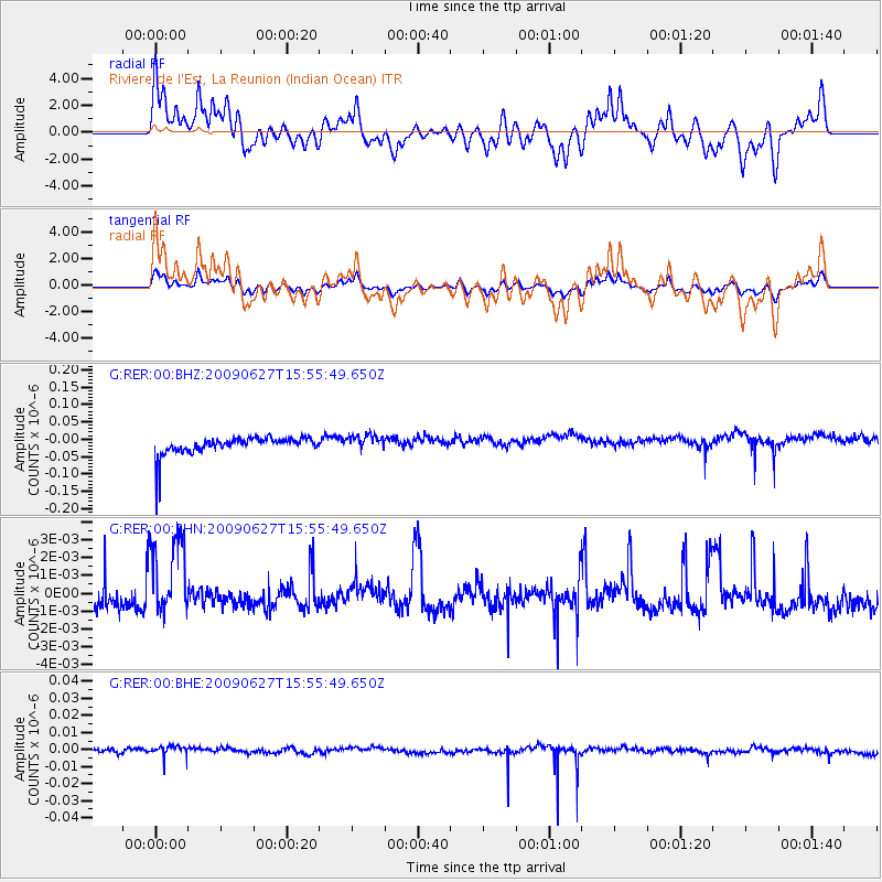
RER Riviere de l'Est, La Reunion (Indian Ocean) - Earthquake Result Viewer
*The percent match for this event was below the threshold and hence no stack was calculated.
| Earthquake location: |
Southern Mid-Atlantic Ridge |
| Earthquake latitude/longitude: |
-33.2/-15.9 |
| Earthquake time(UTC): |
2009/06/27 (178) 15:45:49 GMT |
| Earthquake Depth: |
13 km |
| Earthquake Magnitude: |
5.6 MB, 5.3 MS, 5.6 MW |
| Earthquake Catalog/Contributor: |
WHDF/NEIC |
|
| Network: |
G GEOSCOPE |
| Station: |
RER Riviere de l'Est, La Reunion (Indian Ocean) |
| Lat/Lon: |
21.16 S/55.75 E |
| Elevation: |
834 m |
|
| Distance: |
63.8 deg |
| Az: |
99.041 deg |
| Baz: |
242.512 deg |
| Ray Param: |
$rayparam |
*The percent match for this event was below the threshold and hence was not used in the summary stack. |
|
| Radial Match: |
56.614857 % |
| Radial Bump: |
400 |
| Transverse Match: |
60.355427 % |
| Transverse Bump: |
400 |
| SOD ConfigId: |
2648 |
| Insert Time: |
2010-02-26 23:46:03.587 +0000 |
| GWidth: |
2.5 |
| Max Bumps: |
400 |
| Tol: |
0.001 |
|
Signal To Noise
| Channel | StoN | STA | LTA |
| G:RER:00:BHN:20090627T15:55:49.650Z | 1.9704392 | 2.5213542E-9 | 1.27959E-9 |
| G:RER:00:BHE:20090627T15:55:49.650Z | 0.6875523 | 4.754855E-9 | 6.9156276E-9 |
| G:RER:00:BHZ:20090627T15:55:49.650Z | 0.85771424 | 2.207127E-8 | 2.573266E-8 |
| Arrivals |
| Ps | |
| PpPs | |
| PsPs/PpSs | |


