You are here: Home > Network List > G - GEOSCOPE Stations List
> Station RER Riviere de l'Est, La Reunion (Indian Ocean) > Earthquake Result Viewer
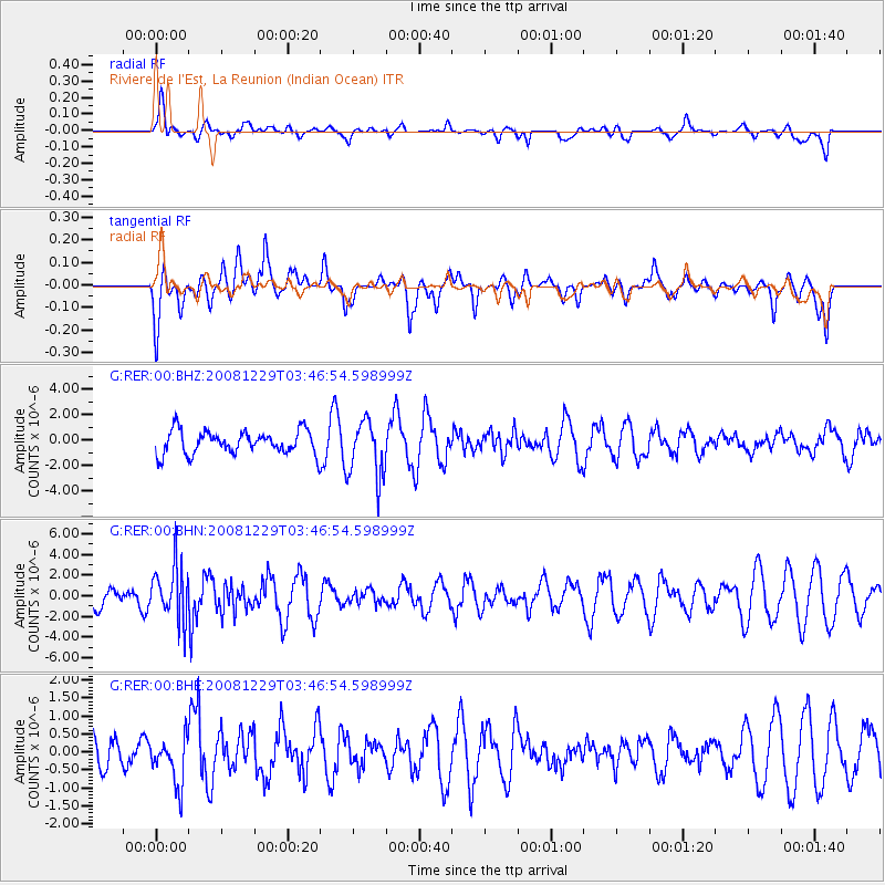
RER Riviere de l'Est, La Reunion (Indian Ocean) - Earthquake Result Viewer
*The percent match for this event was below the threshold and hence no stack was calculated.
| Earthquake location: |
Afghanistan-Tajikistan Bord Reg. |
| Earthquake latitude/longitude: |
36.4/71.1 |
| Earthquake time(UTC): |
2008/12/29 (364) 03:37:41 GMT |
| Earthquake Depth: |
158 km |
| Earthquake Magnitude: |
5.9 MB, 5.8 MW, 5.8 MW |
| Earthquake Catalog/Contributor: |
WHDF/NEIC |
|
| Network: |
G GEOSCOPE |
| Station: |
RER Riviere de l'Est, La Reunion (Indian Ocean) |
| Lat/Lon: |
21.16 S/55.75 E |
| Elevation: |
834 m |
|
| Distance: |
59.1 deg |
| Az: |
196.721 deg |
| Baz: |
14.399 deg |
| Ray Param: |
$rayparam |
*The percent match for this event was below the threshold and hence was not used in the summary stack. |
|
| Radial Match: |
50.052765 % |
| Radial Bump: |
400 |
| Transverse Match: |
52.61475 % |
| Transverse Bump: |
400 |
| SOD ConfigId: |
2658 |
| Insert Time: |
2010-02-26 23:46:11.971 +0000 |
| GWidth: |
2.5 |
| Max Bumps: |
400 |
| Tol: |
0.001 |
|
Signal To Noise
| Channel | StoN | STA | LTA |
| G:RER:00:BHN:20081229T03:46:54.598999Z | 2.5241675 | 2.7068106E-6 | 1.0723578E-6 |
| G:RER:00:BHE:20081229T03:46:54.598999Z | 1.0798193 | 6.642136E-7 | 6.151155E-7 |
| G:RER:00:BHZ:20081229T03:46:54.598999Z | 2.5342834 | 2.2980616E-6 | 9.067895E-7 |
| Arrivals |
| Ps | |
| PpPs | |
| PsPs/PpSs | |


