You are here: Home > Network List > CI - Caltech Regional Seismic Network Stations List
> Station SLA SLA, Trona, CA, USA > Earthquake Result Viewer
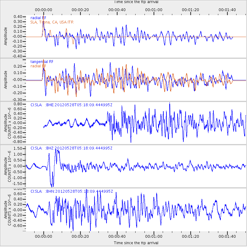
SLA SLA, Trona, CA, USA - Earthquake Result Viewer
*The percent match for this event was below the threshold and hence no stack was calculated.
| Earthquake location: |
Santiago Del Estero Prov., Arg. |
| Earthquake latitude/longitude: |
-28.0/-63.1 |
| Earthquake time(UTC): |
2012/05/28 (149) 05:07:23 GMT |
| Earthquake Depth: |
587 km |
| Earthquake Magnitude: |
6.0 MB, 6.7 MW, 6.8 MW |
| Earthquake Catalog/Contributor: |
WHDF/NEIC |
|
| Network: |
CI Caltech Regional Seismic Network |
| Station: |
SLA SLA, Trona, CA, USA |
| Lat/Lon: |
35.89 N/117.28 W |
| Elevation: |
1174 m |
|
| Distance: |
81.5 deg |
| Az: |
318.262 deg |
| Baz: |
133.558 deg |
| Ray Param: |
$rayparam |
*The percent match for this event was below the threshold and hence was not used in the summary stack. |
|
| Radial Match: |
74.97309 % |
| Radial Bump: |
400 |
| Transverse Match: |
75.50671 % |
| Transverse Bump: |
400 |
| SOD ConfigId: |
455246 |
| Insert Time: |
2012-09-24 23:40:00.671 +0000 |
| GWidth: |
2.5 |
| Max Bumps: |
400 |
| Tol: |
0.001 |
|
Signal To Noise
| Channel | StoN | STA | LTA |
| CI:SLA: :BHZ:20120528T05:18:09.444995Z | 8.168576 | 7.4086086E-7 | 9.0696446E-8 |
| CI:SLA: :BHN:20120528T05:18:09.444995Z | 1.9114808 | 2.5456742E-7 | 1.3317812E-7 |
| CI:SLA: :BHE:20120528T05:18:09.444995Z | 1.1766541 | 1.03250144E-7 | 8.774894E-8 |
| Arrivals |
| Ps | |
| PpPs | |
| PsPs/PpSs | |


