You are here: Home > Network List > CI - Caltech Regional Seismic Network Stations List
> Station MPP McPhearson Peak > Earthquake Result Viewer
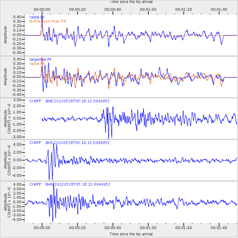
MPP McPhearson Peak - Earthquake Result Viewer
*The percent match for this event was below the threshold and hence no stack was calculated.
| Earthquake location: |
Santiago Del Estero Prov., Arg. |
| Earthquake latitude/longitude: |
-28.0/-63.1 |
| Earthquake time(UTC): |
2012/05/28 (149) 05:07:23 GMT |
| Earthquake Depth: |
587 km |
| Earthquake Magnitude: |
6.0 MB, 6.7 MW, 6.8 MW |
| Earthquake Catalog/Contributor: |
WHDF/NEIC |
|
| Network: |
CI Caltech Regional Seismic Network |
| Station: |
MPP McPhearson Peak |
| Lat/Lon: |
34.89 N/119.81 W |
| Elevation: |
1739 m |
|
| Distance: |
82.4 deg |
| Az: |
316.104 deg |
| Baz: |
131.798 deg |
| Ray Param: |
$rayparam |
*The percent match for this event was below the threshold and hence was not used in the summary stack. |
|
| Radial Match: |
72.23013 % |
| Radial Bump: |
400 |
| Transverse Match: |
78.223366 % |
| Transverse Bump: |
400 |
| SOD ConfigId: |
455246 |
| Insert Time: |
2012-09-24 23:41:07.498 +0000 |
| GWidth: |
2.5 |
| Max Bumps: |
400 |
| Tol: |
0.001 |
|
Signal To Noise
| Channel | StoN | STA | LTA |
| CI:MPP: :BHZ:20120528T05:18:13.694995Z | 7.3667803 | 1.5727188E-6 | 2.1348795E-7 |
| CI:MPP: :BHN:20120528T05:18:13.694995Z | 3.6699834 | 9.0652134E-7 | 2.4700967E-7 |
| CI:MPP: :BHE:20120528T05:18:13.694995Z | 2.9064426 | 4.706607E-7 | 1.6193702E-7 |
| Arrivals |
| Ps | |
| PpPs | |
| PsPs/PpSs | |


